|
Home | Blog Index | Blog Archives | Christianity & Faith Essays | Storm Chasing Essays
Kentucky-Indiana chase on July 26-27; Lake Erie on July 16
Here's a roundup on some storm chasing and traveling during the second half of this month:
EXPEDITION VIDEO: Kentucky and Indiana chase - July 26-27
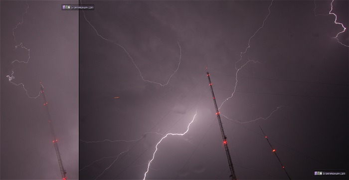
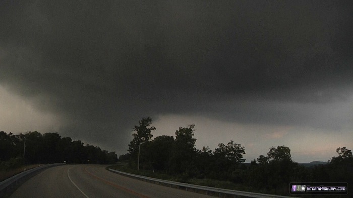
July 26: A couple of days after arriving home from a trip to Pennsylvania, I turned right around and headed back east to chase a two-day severe weather event. Saturday's target was more or less in my backyard along I-70 and I-64 in south-central Illinois. This target didn't pan out, with storms going outflow dominant quickly. I headed on east intending to shoot the storms (now a squall line) in Louisville. The line caught me at Evansville however, and there would be no getting ahead of it again with the torrential downpours in the cores. I made it to the towers on Floyds Knobs in New Albany, Indiana (across the river from Louisville) just in time for the squall line's stratiform precip area, grabbing a couple of shots of lightning through the windshield (with one small channel connecting to one tower):
July 27: The main event of the system was to be in eastern Ohio/Kentucky into West Virginia on Sunday the 27th. I spent the night at a hotel in Louisville, and was back on the road east in the morning. I played around with a few of the early storms between Louisville and Lexington, which didn't amount to much. Rain and cloud cover from these early storms was complicating the chase target. Finally, I decided to play the area of clearing to the north along the Ohio River rather than cover the strengthening supercells down south into Tennessee. I expected a second round of supercells to fire by late evening, and that finally happened.
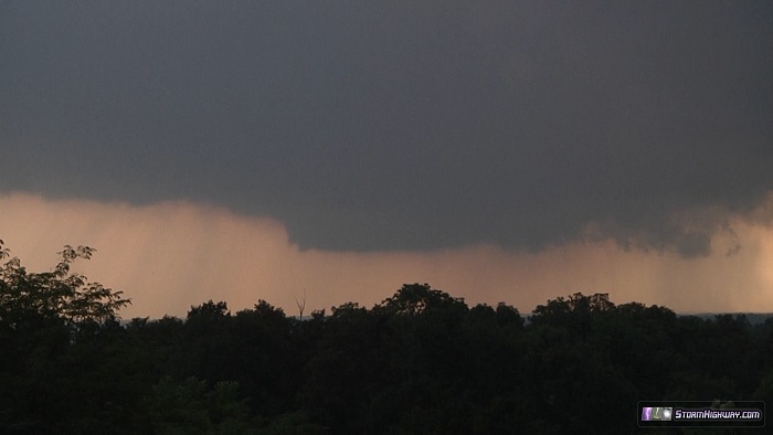
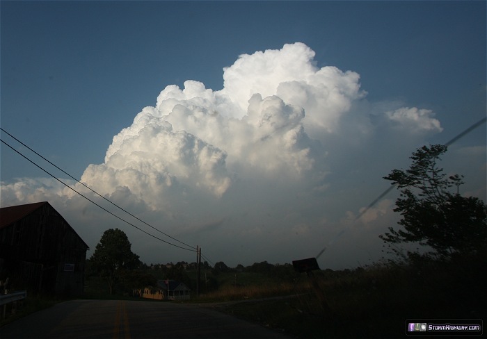
I jumped on the first storm in Cynthiana, Kentucky (south of Cincinnati) and stayed just ahead of it for the next hour or so. I finally let it approach near Ewing, northeast of Lexington. The base looked healthy, with a wall cloud developing at several intervals:
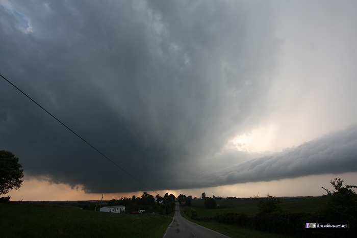
I moved down to Hill Top, where the storm exhibited great structure - the best I'd seen in this region, even counting the 16 years I had lived in West Virginia and observed storms around the area.
I stayed with the storm to its Route 11 crossing south of Flemingsburg. A strong RFD gust front curled around to the south, while the large arcus along the forward flank core and the updraft base to the east raced into the meso. There was rotation at the point where these converged, and it appeared the storm could produce a tornado at any time. I don't know that it didn't produce, since the trees and hills blocked my view for most of the chase.
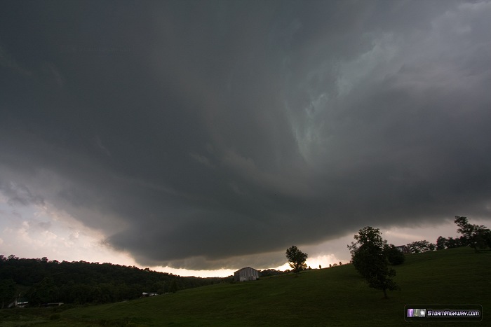

I watched for tornado vortices on the ground as the center of circulation passed nearly overhead. Motion was impressive. I think the RFD was surging and undercutting the meso too much for anything to spin up at the surface, but it really had the 'look' here:
I didn't have great road options to stay with the storm, which was racing off to the southeast. The view of the frontlit cumulonimbus was impressive:
I dropped south to I-64 at Owingsville, and barely met the storm's meso again as it crossed the interstate at the Sharkey/Farmers exit. The RFD and forward flank gust fronts seemed to be overpowering everything at this point, having merged into a continuous surge of outflow pushing out ahead. I didn't see any solid updraft base at this stage - and it didn't matter anyway, as I had no good roads to keep up with the fast-moving storm.
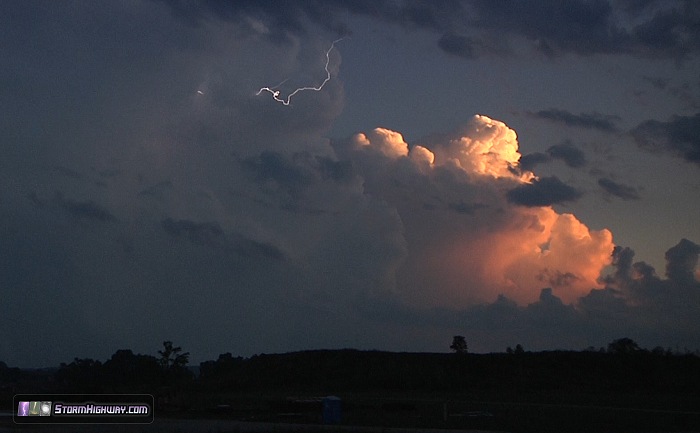
I then focused on getting east to observe another cell heading toward an I-64 crossing at Grayson, though it didn't seem to have any low-level organization on radar. Meanwhile, my original storm was putting on a nice lightning show with another sunset-lit cumulonimbus to the south. This proved a worthy subject:
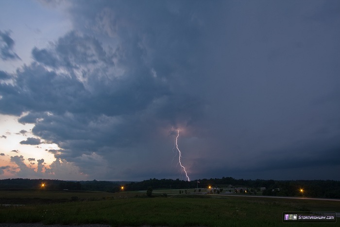
The Grayson storm rapidly weakened, providing only one lightning shot south of Argillite before the rain arrived:
Facing a long drive back to St. Louis, I chose not to stay for an additional line of cells moving in from the north, which looked to provide little more than an average lightning photo or two. I arrived home at 2:30AM.
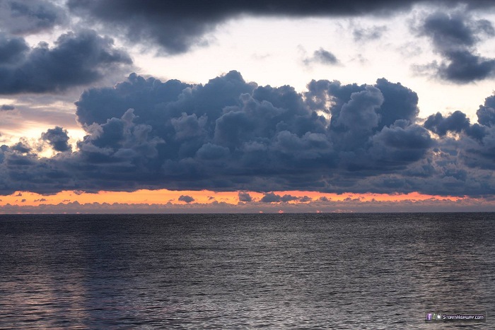
July 16: Earlier, I went on what has become a more or less annual "family and friends" trip in mid-July. One the way, unseasonably cold temperatures over the Great Lakes meant a chance for waterspouts, so I took the long way home to Pennsylvania, stopping at Marblehead, Ohio to watch for waterspouts over Lake Erie. There were none to be seen, but the sunrise over the lake was nice:
|


