|
Home | Blog Index | Blog Archives | Christianity & Faith Essays | Storm Chasing Essays
April 27-28 storm chase days in Illinois/Missouri
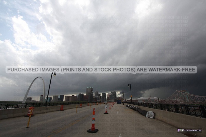
HD VIDEO: Supercell from St. Louis to Sullivan, Illinois - April 28, 2014
(Photos below)
After nearly a week of intensive forecasting efforts, I finally decided against a Plains storm chase expedition for the potent upper level trough moving through over the weekend. The St. Louis area and adjacent areas of the Midwest would also see a risk for tornadoes from the same system. For that reason, it was a fairly easy decision for me to save my money and cover the local threat, instead of embarking on a long and expensive multi-day trip to the Plains and/or the South.
Saturday, April 26: What was originally shown to be the first setup afforded by the upper system ended up busting thanks to capping, late arrival of the upper support and the shallow moisture mixing out. Models picked up on all of this well in advance, and I so never left home to chase on Saturday.
Sunday, April 27: All ingredients came together to make Sunday's setup the first big tornado event of the spring season in the Plains/Midwest. Upper support overspread a deep moist warm sector, while a surface low backed the low level winds. There were three targets: the dryline/cold front in western Missouri, the open warm sector in Arkansas, and the warm front in Missouri/Illinois. All three areas had adequate environments for tornadoes (directional shear, lift and instability). Since the warm front was in my backyard, it was my obvious choice despite it not being as strong of a play as the other two areas.
I departed St. Louis before noon as elevated storms began firing just north of the warm front in the St. Louis metro. Storms finally began firing south of the front just west of Wentzville, so I headed up Highway 61 to follow this activity northward. The warm front was rapidly lifting northward, and the storm cluster I was on never seemed to be able to catch up to it nor really get organized. I finally let the storm go at Hannibal. At this point, a messy line of severe storms was moving in from the west, but rapidly lost intensity as it approached Highway 61. I eventually called off the chase and headed home, just ahead of the dissipating line.
The rest of the night, weak storms and stratiform rain/thunderstorms with low cloud bases and fog moved over the metro area, hopelessly stabilizing the region against any possibility of even a decent lightning show. As the night progressed, the stratiform region lightning increased in intensity and became somewhat more visible east of St. Louis. This was all for nought, as I had to call it a night and fall asleep in the midst of the storm to rest up for the next day's event.
Monday, April 28: Yet another case of "tornado-outbreak-somewhere-else-but-slight-tornado-risk-at-home" again influenced my decision to not travel out of the area, which in this case would have been south for the outbreak in Mississippi. A somewhat better setup for tornadoes than we saw the previous day in the St. Louis area would be present, so it was a no-brainer for me to save my travel funds and chase locally.
I made the first intercept of the day near Hawk Point, Missouri. The storm rapidly intensified right overhead, with fast rising and horizontal cloud motion converging into a deepening HP notch. However, I lost the storm quickly due to the torrential precip overtaking me on the winding, curvy roads west of Highway 61 at Moscow Mills. With no other options to keep up and with new storms moving into the heart of the metro area, I let this first storm go. I jumped back down to I-70 east and scurried downtown to meet the tail-end storm moving up along I-44.
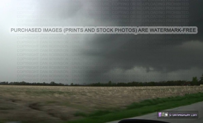
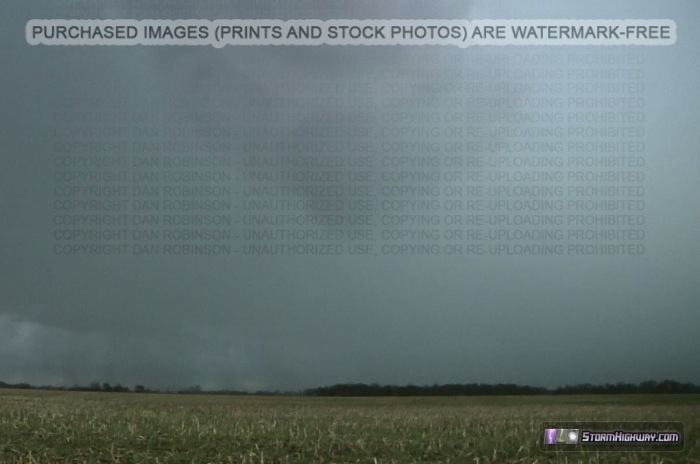
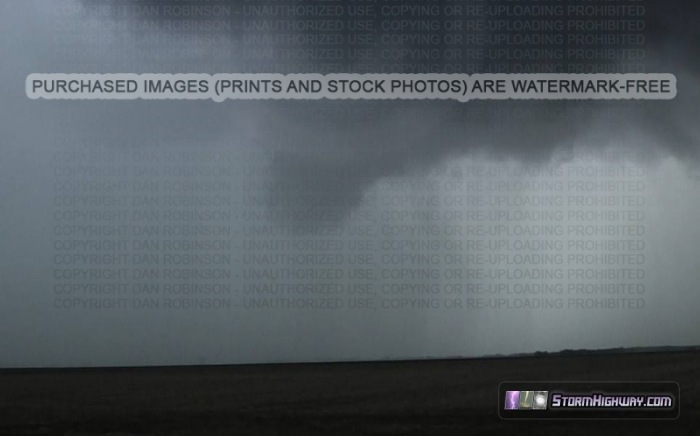
I moved up I-55 in Illinois to stay with an area of rotation that began showing up on radar. Eventually a hook and visually distinct HP notch developed at Edwardsville, and the storm became tornado warned as the circulation tightened. From this point onward, the storm maintained the HP structure, rotation and notch. I struggled to keep up with it by stairstepping on the county road grid, all the way to Sullivan. On the way there, I gained several views of features inside the notch of the storm. I observed some weakly-rotating funnels that appeared ominous, but each dissipated quickly before getting close to producing.
|


