|
Home | Blog Index | Blog Archives | Christianity & Faith Essays | Storm Chasing Essays
DAY 2: St. Louis to Oklahoma City
Wow, Monday and Tuesday's tornado outlooks look great. More on that later! After a short night's stay near Springfield, I was back on I-44 westbound by 7AM. Most of the area along I-44 in southwestern Missouri was still showing the heavy damage from the winter's ice storms. Every tree had at least minor damage, and in some spots the destruction was almost indistinguishable from a tornado damage path. It looked as if a giant lawn mower had lopped off the tops of all the trees everywhere.
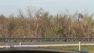
Springfield, MO ice storm damage
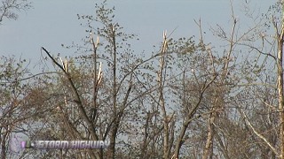
Damaged treetops in Springfield
I crossed the Oklahoma state line just before 9AM.
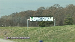
Crossing into Oklahoma
Now take a look at that last image (and the Missouri tree damage photos, for that matter). Notice that most of the trees have not started budding and leafing yet. Spring 'greenage' seemed to drop off to near nothing along the Missouri/Oklahoma line. In fact, of everywhere I saw in daylight the past two days, Charleston back home had more green than anywhere in Kentucky, Indiana, Illinois and Missouri. That fact surprised me, but not as much as what I saw as I drove further into Oklahoma.
Here is the giant McDonald's near Vinita, OK that spans the Interstate. This is supposed to be the biggest McDonald's in the world.
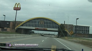
Vinita McDonald's on I-44
Now look closely in the distance in that last image. You see that on the horizon? Green! Not just spotty green, but fully leafed trees. In a short distance near Vinita, the trees suddenly went from barren to near-fully leafed, and it continues that way from that point westward. This is puzzling, as there is no dramatic change in elevation, climate or tree type between Joplin and Tulsa. The only explanation I can figure is that this region has been in drought for some time, and recent heavy rains may have been localized enough in Oklahoma that the drought has been alleviated there - with a sharp cutoff of rainfall totals in northeast Oklahoma.
Here you can see the state of the trees in Claremore as a train rolls through town.
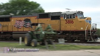
Union Pacific train in Claremore
This train rolled right by where I ended up going to worship services, at First Baptist Church of Claremore. After church, it was on to Tulsa.
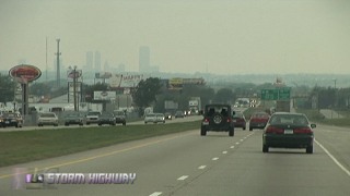
Tulsa skyline in the distance
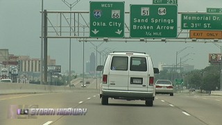
Getting ready to head for OKC
I drove through a marginal cumulus field between Tulsa and Stroud, but opted to ignore the slight threat for storms, as they would likely take me too far away from our lodging point tonight. I arrived in OKC around 3:30PM and am currently at a hotel on Meridian west of town.
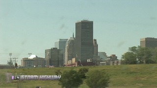
Finally, Oklahoma City
Matt's plane is scheduled to arrive at 10:08PM. I'm only a few minutes from the airport, so I've got some time to relax and prepare for the next two days, which, from a forecasting standpoint, look to be banner tornado setups.
GO: Home | Storm Expeditions | Photography | Extreme Weather Library | Stock Footage | Blog
Featured Weather Library Article:
|