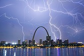
February this year was more like March: I observed lightning on five different days, captured lightning stills three times and saw the first tornado of the year - all within the state of Illinois. There was more convective weather than winter weather, with only one winter storm in the St. Louis metro. That single event yielded some dramatic drone footage. This recap covers events from January 30 through the end of February 2024.
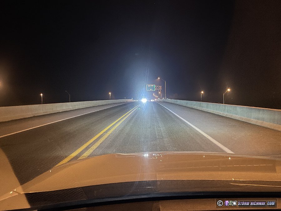
Models were showing a potential surprise freezing rain icing event in southern Indiana on this morning, so I decided to make the 2-hour drive to document it. Temperatures were only at freezing and slightly below, with not much room to wet-bulb down - so I was not expecting a big event. When I arrived in Evansville at dawn, I was suprised to find bridges already iced from frost:
I saw the aftermath of one loss-of-control incident at the I-69/I-64 interchange from this. I was curious if the rain would immediately worsen the bridge icing, since they were already "primed" from the frost. Icing can happen faster when there is already existing ice for the new precipitation to nucleate on. However, when the rain arrived, it immediately melted the ice on the bridges: the raindrops had not been able to cool to freezing due to the marginal surface temps. I didn't cpature any footage, and arrived back home before noon.
This event looked like a legitimate tornado opportunity for northern Illinois in the days leading up to it, but when the morning of the event arrived, I was pessimistic. Moisture was not moving north fast enough, and it was very cold in the St. Louis area by mid-morning (the upstream air for the setup). Nonetheless, short-term models hinted at some storms along I-72 near Springfield in a decent environment for supercells. That would be close enough for me to go check out.
I departed home at 11AM, and drove north, stopping several times to look at data to watch the evolution of the conditions. Models backed off of the southernmost storms, but maintained healthy-looking supercells a little farther south than I originally expected (down near Peoria/Bloomington). I decided to go the extra 90 minutes north to El Paso (east of Peoria).
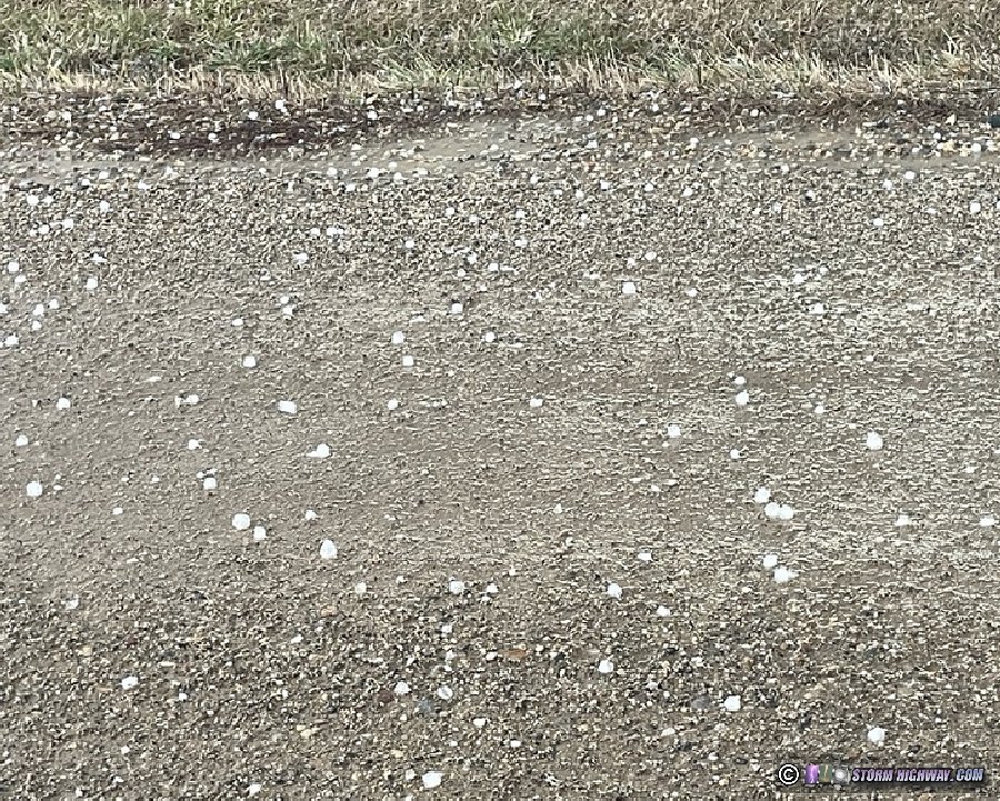
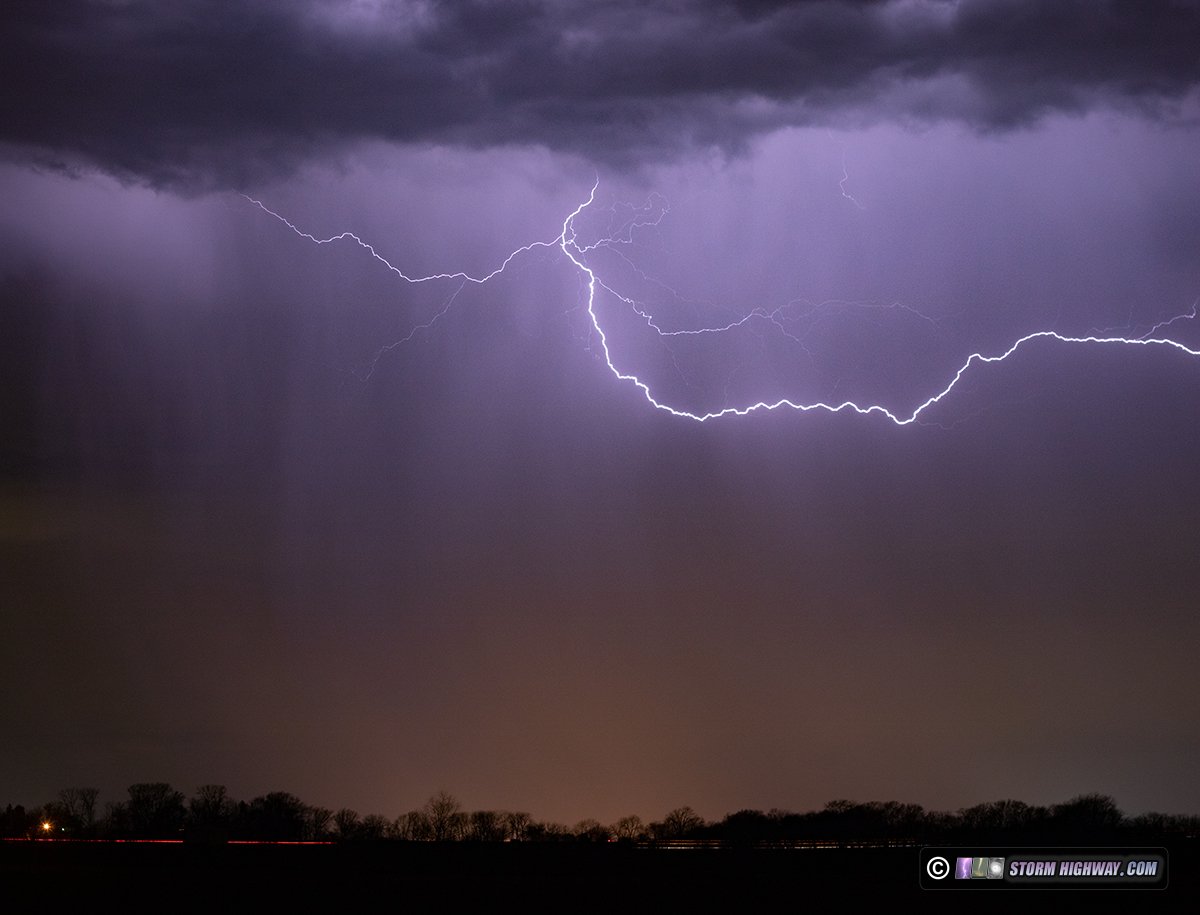
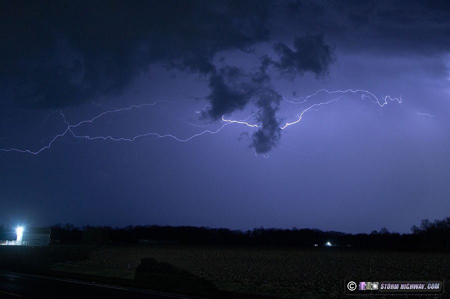
I intercepted the first storm of the day west of Lacon on Highway 17. I waited for the updraft base to arrive, seeing a good downpour of hail larger than quarters.
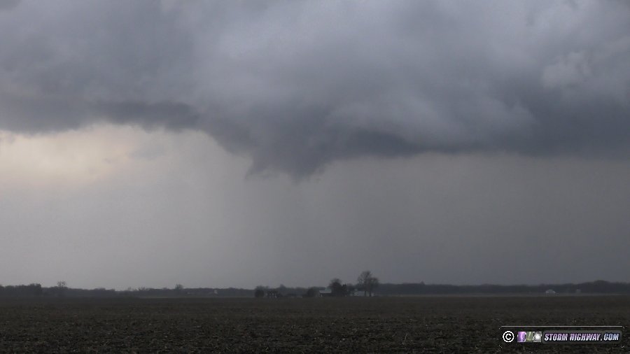
The storm was moving much faster than I'd anticipated. It rapidly got away from me while I drove back east through Lacon. During that time, a large RFD cut developed over (or just north of) town. On the east side of town, I encountered large tree debris in the road. At the first clearing to the north, I could see a rapidly rotating bowl with a debris cloud in progress underneath.
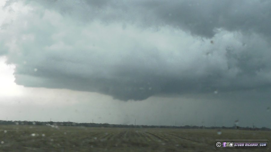
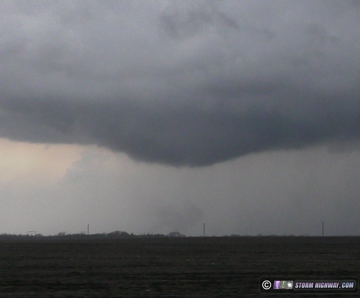
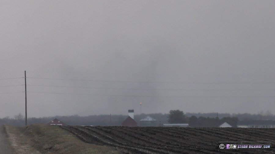
Due to the storm speeds, I didn't attempt to stay with the meso. Instead I watched it move away to the north-northeast. Several other significant lowerings developed with what appeared to be the same circulation, but were too far away to confirm rotation or ground contact.
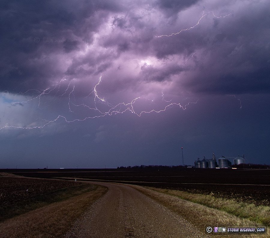
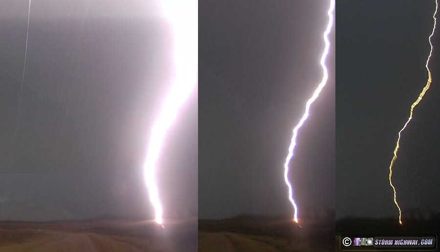
I had originally planned to try to make it to Chicago for upward lightning once storms started lining out, but everything was moving much too fast for that to be possible. Instead, I parked near Varna and shot lightning stills and high-speed video until after sunset.
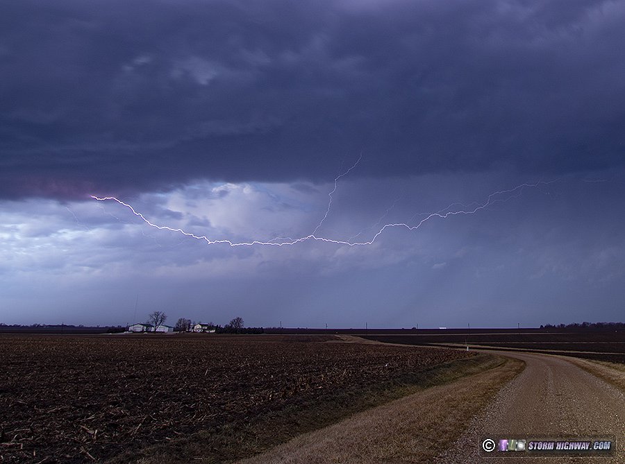
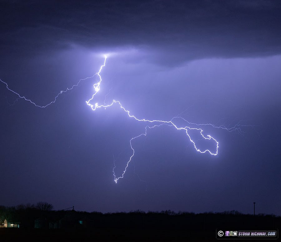
During this stop, this close strike happened to my north. I missed it on my primary cameras, but the front dashcam barely got it:
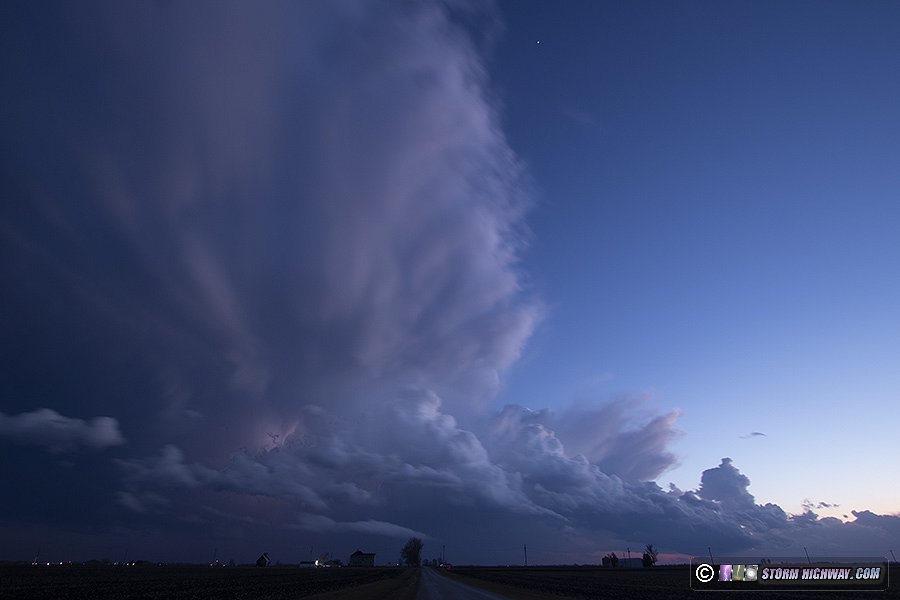
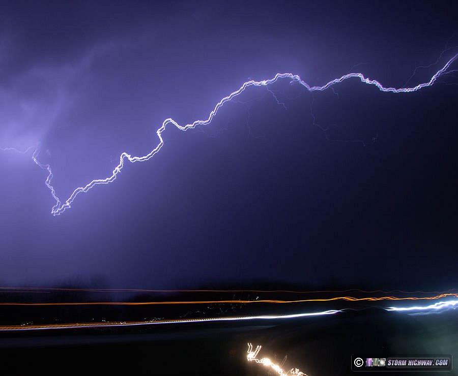
The departing storms at twilight were spectacular, but the clouds were blurring severely at even 3-second exposures with a 10mm wide-angle view - a testament to how fast the storms were moving.
I arrived back home at 9:30PM, making it a just over 10-hour trip.
February 10: Southern Illinois lightning
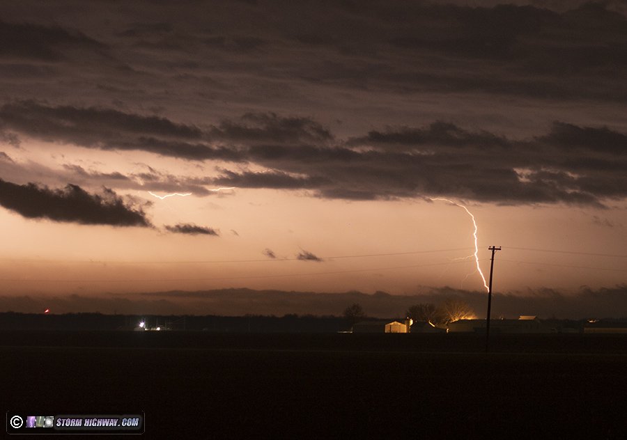
This event kept looking lesser-than-ideal to chase with each new data update: mostly after midnight, meager instability and not-great roads/terrain to stay with and observe the best storms. The storm motion would be in one of the worst configurations for a chase this close to home, well south of I-64 and a nearly 2-hour drive to get back home afterward at possibly later than 4AM. I decided to wait at home to see how things played out, intending to get on the road east or south if it looked better than I expected. Despite the storm of the day near Perryville/Chester ramping up, I wasn't impressed enough to make the more than an hour drive needed to get in front of it. Instead, I drove south just outside of town to see if any of the lightning was visible from here. Even that wasn't very impressive, but I set up the DSLR for about 20 minutes with the 50mm anyway. There were only a couple of visible lightning channels, but I managed to catch one of them. This bolt was about 40 miles away to my southeast.
February 15: New Baden, Illinois lightning
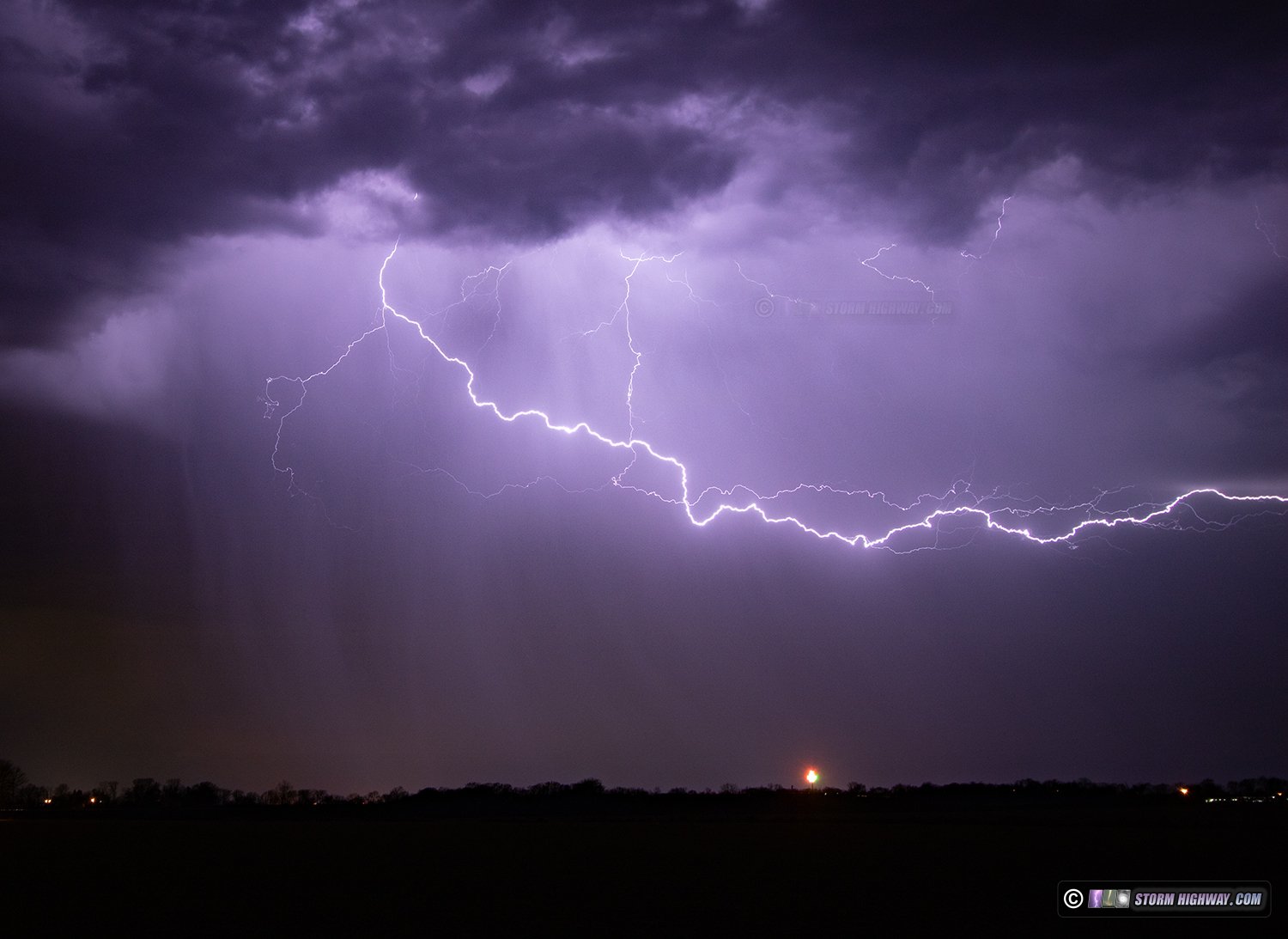
A bit of a surprise this morning as marginal thunderstorms, originally expected to remain west/north of us overnight, came right through the St. Louis metro before dawn. A few of the intracloud lightning flashes featured vivid negative leaders below cloud base, illuminating the rain shafts. I captured these just down the street from my apartment, looking west.
February 16: St. Louis snow and icy roads
A typical all-day outing to cover another winter storm in the St. Louis metro. This was a 25-hour day for me, having worked one of my normal IT job shifts immediately prior to the storm. I left work at 4AM and headed up to Eolia along Highway 61 where the first heavy band of snow was covering the roads. The snow and surface freezing temperature line slowly moved south through the morning, so I stayed in this area down to South County where I observed the highest impacts. At the peak of the event, the primary road issues wre from vehicles unable to make it up hills. This created numerous long traffic backups both on the main highways and the side streets. I captured this footage along Union Road:
Something I've observed with numerous winter storms is that accident rates increase after the storm as salting/plowing crews start clearing things up. Traffic speeds immediately increase as a result of this despite the fact that there are still a lot of icy spots yet to be cleared. When traffic encounters these spots at high speed, loss of control incidents occur. I encountered one such spot on the southbound I-55 interchange ramp to I-255 where at least five incidents occured. I captured three of them with the drone. One of the incidents occurred after first responders arrived, narrowly missing a firefighter and another previously-wrecked motorist who was standing outside of their car.
The roads were still not completely clear after sunset, but I'd reached the end of my awake time and had to call it a day at 9PM.
February 18: St. Louis snowmelt icing
In certain circumstances, snowmelt can create icy roads. The setup for this is when a warm day (at least 10 or so degrees above freezing) occurs immediately after a snowstorm where more than 3 or 4 inches has accumulated, followed by temperatures dropping back below freezing that night. Moderate to heavy snow events result in large piles of plowed snow along the sides of roads. When this snow melts rapidly during a warm day, the meltwater can flow back onto the road and then refreeze when temperatures drop below freezing again.
The February 16 snowstorm in St. Louis would present this type of hazard when temperatures warmed into the mid to upper 40s on the 18th, then dropped into the upper 20s that night. I went out to monitor this hazard around the metro, encountering this example on I-255 at the Highway 3 interchange in Columbia. The bridge was already getting slick when I passed over this just after midnight, which I called in to the Illinois highway patrol.
After this, I made a circuit around St. Charles County where the highest snow totals of the event were recorded, but found no other examples of snowmelt icing.
February 27: Highland, Illinois thunderstorm
Models indicated a long-duration round of overnight warm advection thunderstorms in the predawn hours of the 27th, mainly along and south of the I-64 corridor in southern Illinois. That depiction was mostly wrong, with only a few weak cells firing along I-70 northeast of St. Louis. I set up for these just south of Highland. While they produced lightning for a few short intervals, it was all inside of the clouds. No photos or videos captured.
February 27: Southern Illinois lightning
A bimodal severe weather event was in play this day, with setups for tornadoes in both northern and southern Illinois. While the northern area was much more favored, the parameters looked good enough in the southern area that I decided I liked that 1 to 3 hour drive in my backyard over the 6 hour (one way) option to the north. I left home at 4PM to stage near Mount Vernon as several radar echoes suggested that storms might initiate somewhere in the I-57/I-64 corridors before sunset. When this didn't happen, I returned home to await the main event slated for overnight.
The rare-for-the-Midwest dryline retreated back west through the afternoon, stalling right over St. Louis. The main question was if storms could initiate ahead of the cold front east of the dryline, without which the tornado threat would be virtually zero. As the cold front began overtaking the dryline in the St. Louis metro, a storm managed to go up just ahead of it, tracking right along I-70. I intercepted this storm at Highland, setting up for lightning stills.
The storm was racing to the east-northeast, and by the time I got back on I-70, it was already 10 miles ahead of me. I never did catch up again, despite traveling at interstate speeds parallel with the storm motion. I shot a few handheld time exposure stills out of the front windshield as I tried unsuccessfully to get back ahead.
At Altamont, I decided I'd had enough with the futile pursuit. I exited the interstate and set up for tripoded stills again as the storm moved off to the northeast.
During this stop, the cold front overtook me, with a pronounced roll cloud just behind it. A second storm had developed behind the first one, but all behind the cold front where visibility of the lightning channels was not good. After watching dozens of bright flashes with no visible channels, I gave up on the second storm and set my sights on another area of cells moving up from the Mississippi River valley to the distant southwest.
This next area of activity would cross I-64 around Nashville, so I headed down to south of Irvington to watch it approach. Lightning activity was weaker with this cell, and it was already behind the cold front - but some lightning channels were still visible. I set up for about 15 minutes here, but the storm didn't produce another visible channel after I started shooting. The strong cold westerly wind behind the front was also blowing rain into the lens, prompting me to just call the day's chase well before the storm's core reached me.
February 28: St. Louis area snow
The precipitation on the back edge of the system that brought the severe storms to the Midwest changed over to snow as temperatures dropped behind the cold front. Some of these shallow snow bands moved through the St. Louis metro between 3 and 5AM, but they did so just before temperatures dropped below freezing. I went out for an hour in the Metro-East monitoring road conditions, and didn't find any snow accumulating due to the temperatures being too warm. No photos or videos captured.
GO: Home | Storm Expeditions | Photography | Extreme Weather Library | Stock Footage | Blog
Featured Weather Library Article: