|
Home | Blog Index | Blog Archives | Christianity & Faith Essays | Storm Chasing Essays
April 2024 Storm Chasing Recap
This is a running-updates post for events covered in April 2024.
April 2024 Event List
- April 1: St. Louis supercell and lightning
- April 2: Jeffersonville, Indiana tornado (Louisville metro)
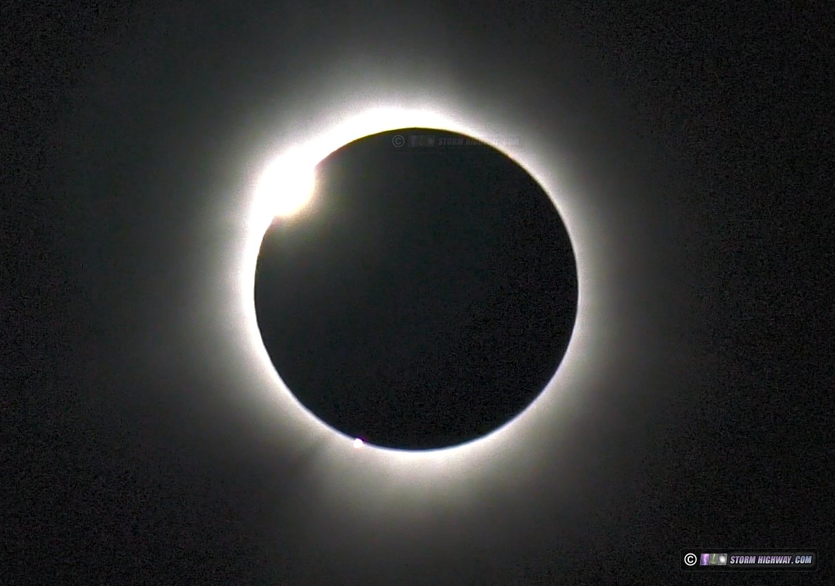
- April 8: Total solar eclipse of April 8, 2024: Vermont and New Hampshire
- April 11: Lightning at Richmond, Indiana
- April 15: Dodge City, Kansas supercell
- April 16: Supercells from Topeka, Kansas through northern Missouri
- April 18: St. Louis metro supercells and close lightning
- April 23: St. Louis positive CG lightning
- April 24: Council Grove, Kansas lightning
- April 25: Northwestern Kansas supercells
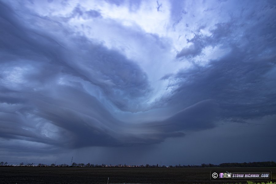
- April 26: Numerous tornadoes from Lincoln, Nebraska to Osceola, Iowa
- April 27: Foraker, Oklahoma tornado, Oklahoma City upward lightning
- April 28: Marginal thunderstorms in eastern Oklahoma/Missouri
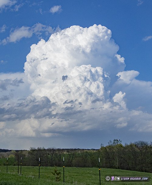
April 1: St. Louis supercell and lightning
Two supercell tornado targets were evident this day. The first, and what I thought was the better, target was along the dryline in southeastern Oklahoma where deep-layer and low-level shear would be very good toward sunset. Models indicated isolated supercells in this area. The second tornado threat was along a warm front that stretched east across northern Missouri into central Illinois, not far from the St. Louis metro area. Supercells were also shown by models south of the front in the St. Louis metro. Although the warm front was the most likely location for tornadoes, the ambient warm sector still had a sufficient low-level wind profile for tornadoes. Again, as I've said many times, if there's a tornado risk at home,. I'm usually not going to go anywhere - and today was no exception.
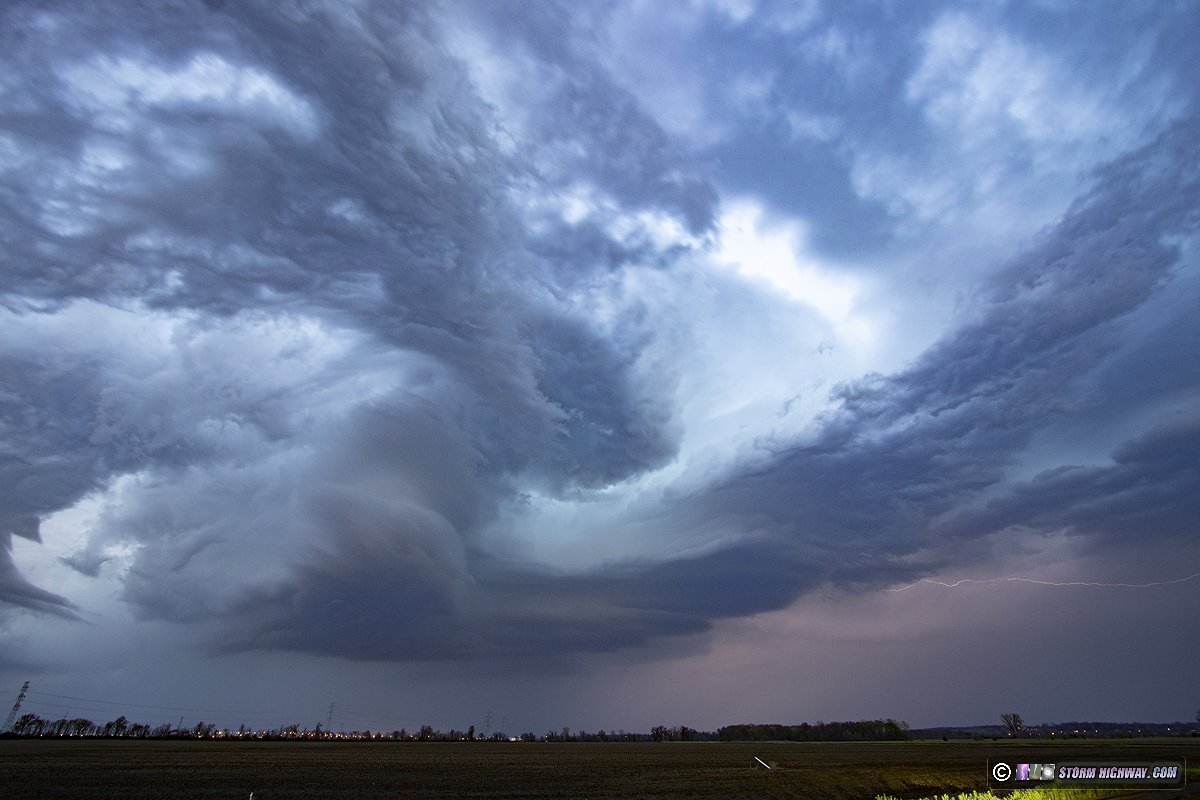
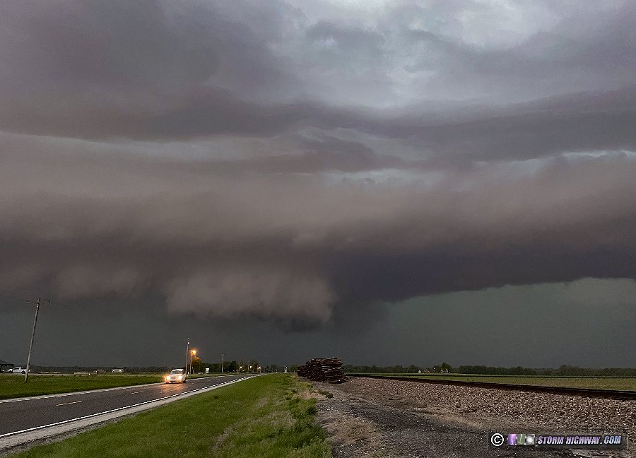
The problem with both targets was extensive cloud cover and precipitation that threatened to greatly hinder destabilization. However, a nice area of clearing had developed in southern Missouri, with that air mass in line to move into the St. Louis area. The warm front itself to the north was completely socked in with clouds and precip, and didn't appear that it would be an option for good storms. I initially drove up to Wentzville to await the development of storms that models suggested would start on the eastern edge of the area of stratiform rain. This indeed did happen, and the first storm ramped up quickly to the southwest. I moved down to Dardenne Prairie to get my first look at it:
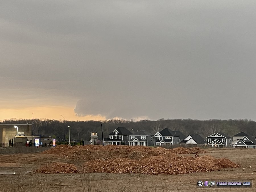
The storm continued to organize and turn hard to the right, with the mesocyclone tracking just south of Highway 40 (I-64). This was the view at Chesterfield.
I moved ahead of the storm to Ladue as the strengthening circulation prompted a tornado warning. An occlusion was visible here, but I had to use my drone to get a view of it. A tornado was confirmed to have just ended or possibly still be in progress at the time of this image.
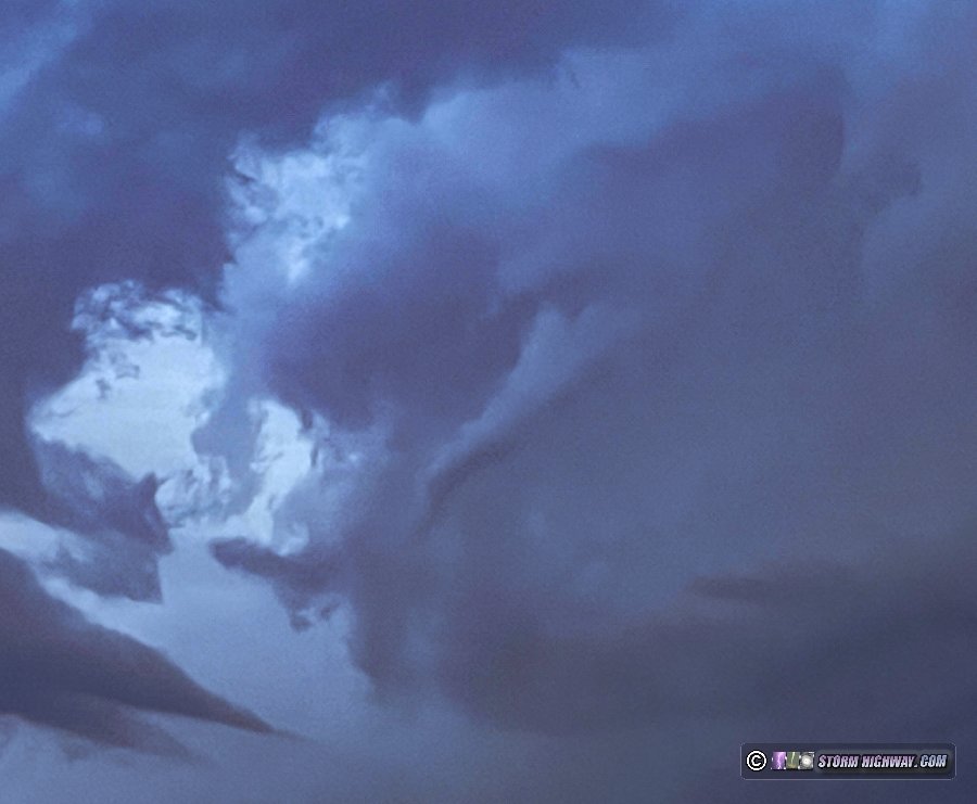
The storm was moving a little faster than I expected, so I decided to go into Illinois to get ahead of it again. I accomplished this via I-255 at Pontoon Beach. The storm's low-level meso had weakened, but it had some interesting laminar stacked plates:
A midlevel funnel appeared on the western side of the storm, apparently associated with an old occlusion:
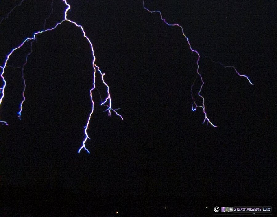
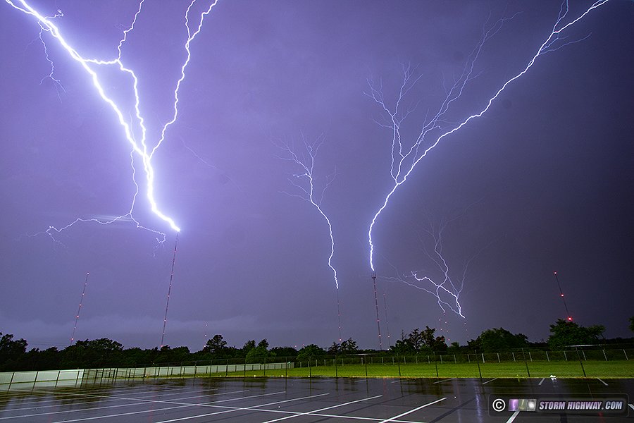
I went back to Brentwood for a short dinner break at sunset, then headed to the parking garage to shoot lightning in the large area of storms and electrified stratiform approaching the area. I ended up having to switch to another location due to the strong southerly winds blowing rain onto the lens, then returning to the parking garage after storm outflow turned winds northwesterly. I only captured one somewhat distant cloud-to-ground bolt while stopped way down during a short interval of close lightning.
With the next day looking to be a long all-day trip, I needed to get home to sleep. I packed up at 11:30pm before the arrival of the last round of electrified stratiform that would be arriving sometime well after midnight.
I captured a tornado in the northern Louisville metro area. This event has its own page here.
Virginia Beach chaser Bill Coyle, my brother and his family from Raleigh, my sister and her family from Boston and I traveled to Vermont and New Hampshire to observe the 2024 eclipse.
This event has its own page with photos, video and a log of the trip.
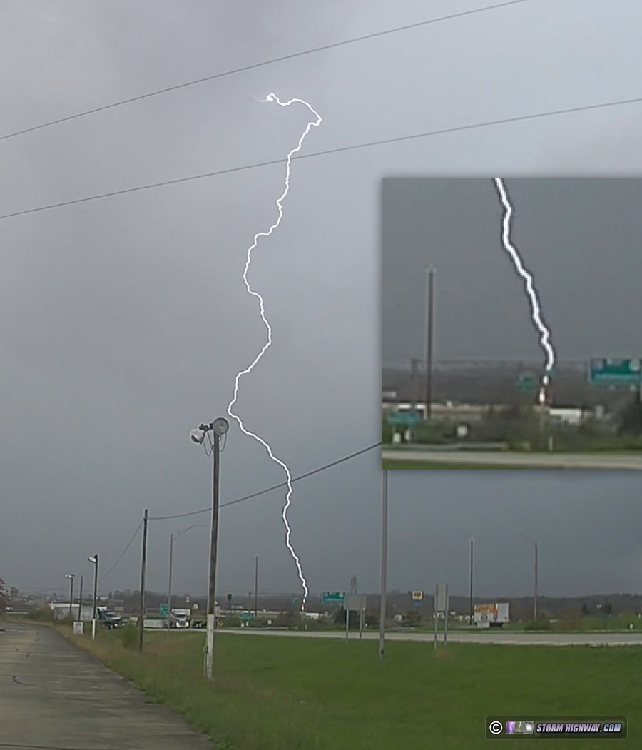
April 11: Lightning at Richmond, Indiana
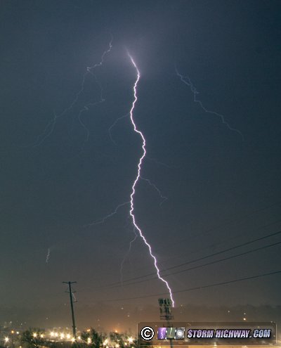
During my return trip westward from the eclipse, I passed through a storm system moving through the Midwest and Appalachians. The 10% tornado risk area in eastern Ohio and West Virginia outlned by the SPC appeared to be busting, thanks to widespread clouds and precipitation early in the day. So, I continued farther west where some breaks in the clouds were creating some instability close to the surface low on the Indiana/Ohio border. The first few blips on radar appeared along I-75 from Cincinnati to Dayton, so I exited I-71 and headed through Xenia to Park Layne to intercept the strongest one. I arrived to find a weak shower with no structure or motion in the updraft base. I headed west on I-70 to the Indiana border where some showers were encountering the area of instability. One of these intensified into a thunderstorm that moved through Richmond. I intercepted it on the east side of town. A hazy wall cloud was visible, but only briefly. There was some sporadic lightning. My dashcam captured a relatively close strike along I-70.
April 18: St. Louis metro supercells and close lightning
My morning was spent getting my windshield replaced and installing the new main rails for the hail shield (see the April 16 log for the story on that). This was another event where the potential for supercells and tornadoes in the St. Louis metro would keep me close to home for most of the day.
A warm front was located in the northern metro area, which was the primary feature of interest to watch. I started out at home watching an area of new storms to my southeast that eventually developed in a promising-looking supercell structure. I could see the base of the storm from home. It appeared that it had a good chance to reach the warm frontal zone roughly along I-70, but as I headed west to intercept it along I-64 at Fairview Heights, it vanished completely.
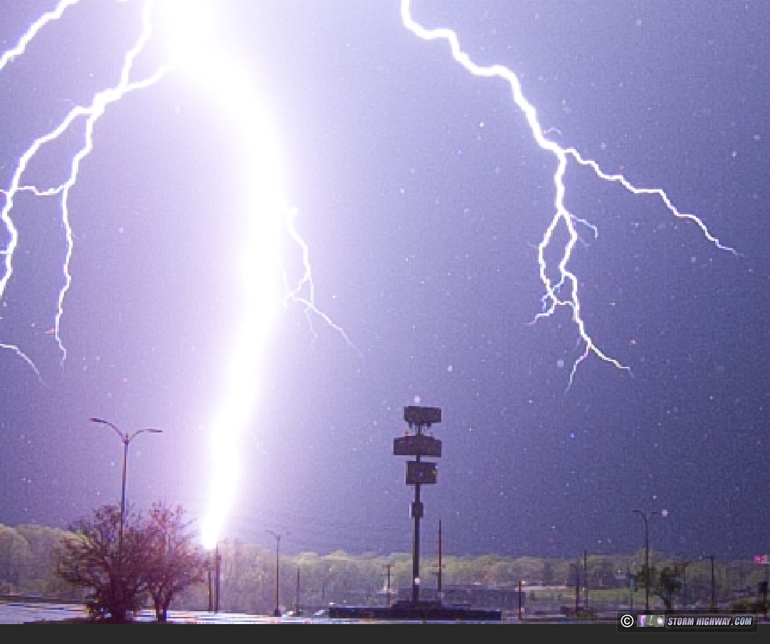
I turned my attention to established supercells moving into the northern metro, noting several cores on radar west of the city that looked like they had potential to organize and come right through the city. The northernmost of these became tornado warned in the unreachable Mississippi/Illinois River confluence area. I waited for it along I-270 at Spanish Lake. New storms started going up ahead of this activity to my southwest, which began producing some good cloud-to-ground lightning. I moved west to Ferguson to get a closer vantage point, and caught a nice negative cloud-to-ground strike on the high speed camera at 6,000fps. This is the stepped leader frame before the return stroke, followed by the return stroke frame (the video is linked below):
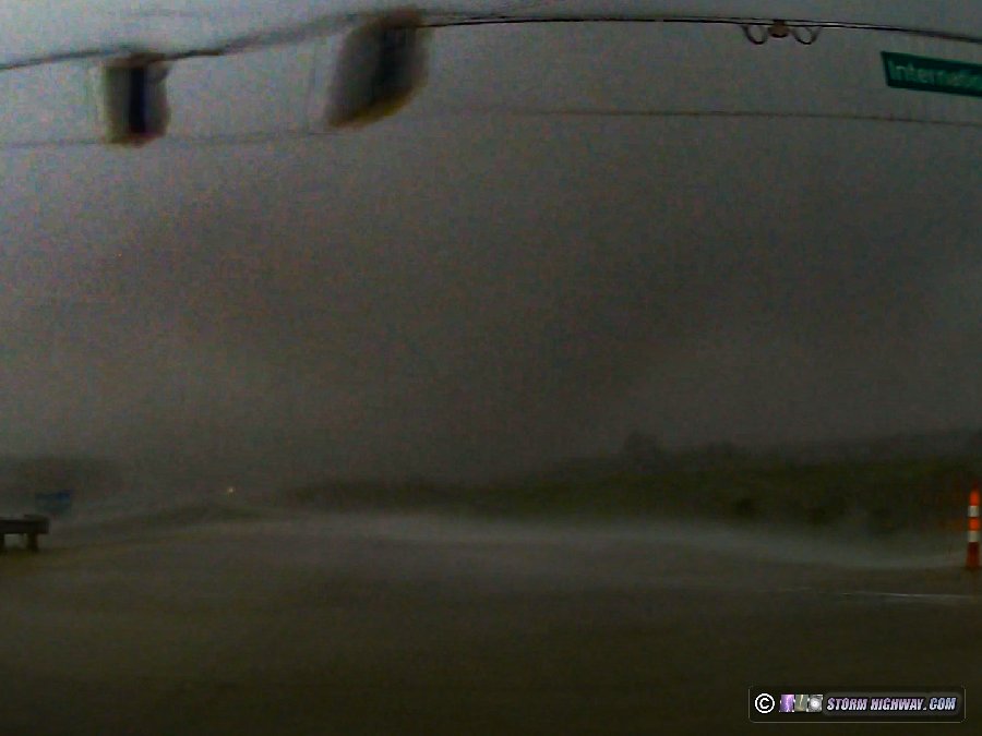
New cells continued to develop through the metro, with a couple of them heading for downtown. I headed south on Highway 67, but these new storms beat me there by about 10 minutes. On the way, my passenger side dashcam captured another close lightning strike to a tree.
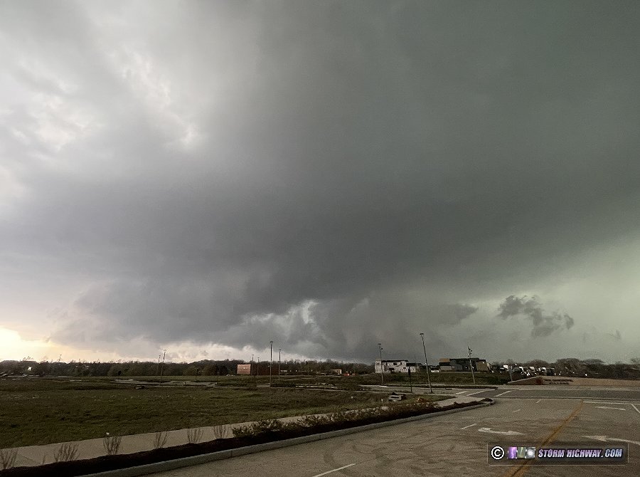
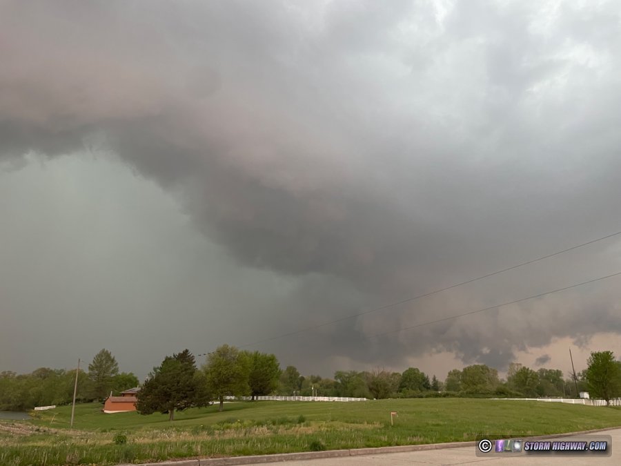
The storms were evolving into a large QLCS with embedded supercell structures, prompting widespread tornado warnings for the numerous mesovortices that were developing along the leading edge. I stayed ahead of these on Highway 161 from Belleville to east of Centralia. The best structure I saw was this, a large RFD surge with forward-flank shelf cloud leading back west into a rain-wrapped meso:
A few persistent mesovortices developed as I led the storms east, but none were close to producing tornadoes when I saw them. This was the better of them near Hoffman:
Tornado sirens were going off in nearly every town I drove through. Seeing nothing of real interest in the fading daylight, I finally turned around just before I-57 and headed back through the storms. Other than some small broken tree branches, I didn't see any real damage.
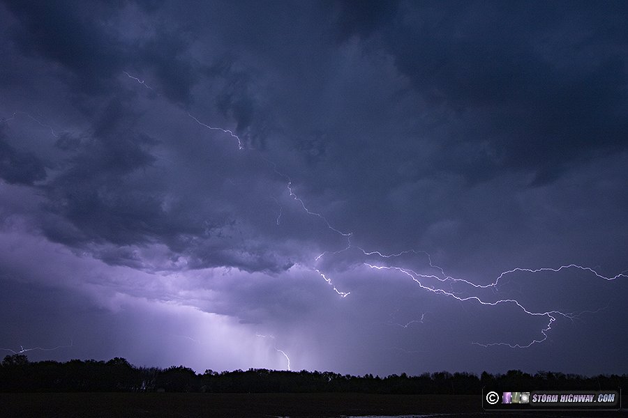
The lightning in the stratiform region was good, but the wind was blowing from the direction the best discharges were happening. I kept driving until I was out of the rain at Bartelso. At that point, there wasn't much to see. I captured one still of lightning from the departing storms before heading home.
The best captures of the day are in this video:
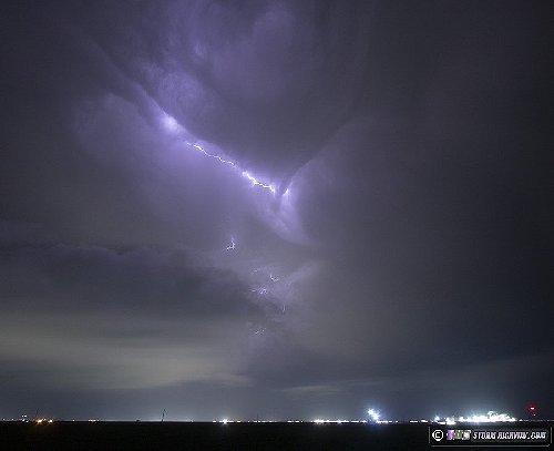
April 23: St. Louis positive CG lightning
Models indicated that this day would, at best, only be good for a local lightning chase (nothing worth traveling out of the area for). At 24 hours out, all models had converged on showing us having no instability and only a line of stratiform rain passing through the metro by evening. I also had to work extra hours to make up for having to take so many days off the past 2 weeks (for the eclipse, last week's Plains trip and windshield repair) while not decimating my PTO, so I didn't really want to spend much time on such a marginal event anyway. As a result, I completely blew off the day and wasn't even keeping an eye on it.
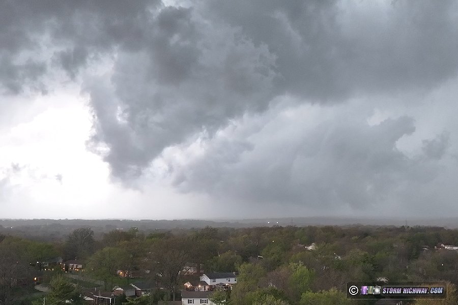
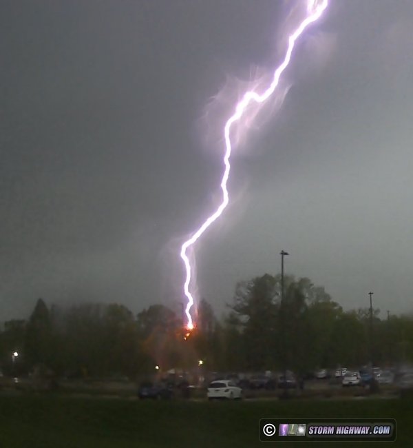
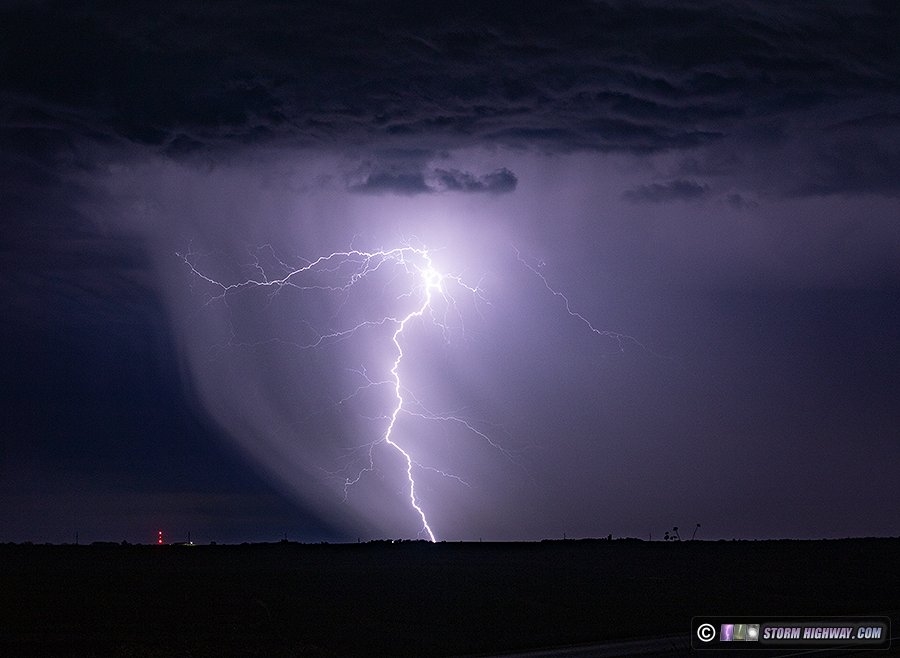
I decided to check radar at 2:30pm, and was shocked to see healthy thunderstorms on the western doorstep of the metro area. And the lightning data display was lit up with strikes. I scrambled to get everything ready, then headed out the door. I made it downtown with only minutes to spare before bolts started appearing over the city. They were all positive cloud-to-ground flashes, quite intense ones with very loud sonic-booming thunder. Remarkably, this was happening while mesoanalysis showed St. Louis outside of the 100 j/kg contour of MUcape! I captured 6,000fps video of a few of the flashes with the high speed camera and recorded audio on my main A camera:
I learned later that there was an upward lightning flash downtown captured by one of the Gateway Arch webcams. I reviewed my dashcam footage to see that I also captured it. It happened in the heavy rain cores of the storms after I'd stopped shooting due to the wind-blown rain.
This tornado outbreak log has its own page here. 11 tornadoes for the day.


April 29: Overnight thunderstorms in the St. Louis metro
As I arrived home at the conclusion of the second Great Plains trip of the season, weak thunderstorms developed ahead of the squall line approaching St. Louis. These storms and the squall line itself were not producing enough lightning to make going back into the city worth it. After one of the lead cells near home started producing a flurry of cloud-to-ground bolts a couple of miles away, I went a mile down the road outside of town to take a look. After watching for about 20 minutes and seeing nothing of photogenic value, I returned home. A few random cloud-to-ground bolts popped off as the main squall line arrived, but again, it wasn't anything that warranted heading back out.
GO: Home | Storm Expeditions | Photography | Extreme Weather Library | Stock Footage | Blog
Featured Weather Library Article:
|