|
Home | Blog Index | Blog Archives | Christianity & Faith Essays | Storm Chasing Essays
Great Plains 2024 Storm Chasing Expedition Logs
This is a running-updates post for 2024 Great Plains storm chasing expeditions.
- Tornadoes: 12
- States: 5 (MO, KS, NE, IA, OK)
- Miles: 4,468
2024 Great Plains Chase Day List
- Day 1: April 14: St. Louis to Junction City, Kansas (Trip #1 Start)
- Day 2: April 15: Dodge City, Kansas supercell
- Day 3: April 16: Supercells from Topeka, Kansas through northern Missouri (Trip #1 End)
- Day 4: April 24: St. Louis to Salina, Kansas, Council Grove lightning (Trip #2 Start)
- Day 5: April 25: Supercells from Goodland to Scott City, Kansas
- Day 6: April 26: Numerous tornadoes from Lincoln, Nebraska to Osceola, Iowa
- Day 7: April 27: Foraker, Oklahoma tornado, Oklahoma City upward lightning
- Day 8: April 28: Marginal thunderstorms in eastern Oklahoma/Missouri (Trip #2 End)
- Day 9: May 5: St. Louis to Emporia, Kansas (Trip #3 Start)
- Day 10: May 6: Barnsdall, Oklahoma nighttime strong tornado
- Day 11: May 7: Marshfield, Missouri to St. Louis (Trip #3 End)
Day 1: April 14: St. Louis to Junction City, Kansas (Trip #1 Start)
I left St. Louis at 11PM in order to make the transit across Missouri on I-70 at the minimum traffic time. The drive was uneventful, and I stopped for the night at Junction City, Kansas.
Day 2: April 15: Dodge City, Kansas supercell
I awoke in Junction City, grabbed a coffee and headed west after doing my morning data check. There were three areas of interest this day (four if you count the Midwest). The first and primary target was dryline supercells in central Kansas that would have the better upper support and moisture, with the drawback of them potentially not firing until after sunset. The second was the warm front in Nebraska, where daytime supercells were more likely but with meager moisture. The third was north Texas, where daytime storms and better moisture were shown, but only for a short time before the cap squashed them. The cap was very strong this day, and looked to impact all three of those areas to some degree. To add another complication, models had been showing warm front storms back home around St. Louis that I was on a hair-trigger to turn around for. In addition, Tuesday's event in the Midwest looked volatile and worth chasing, so I wanted to be able to make it back for that.
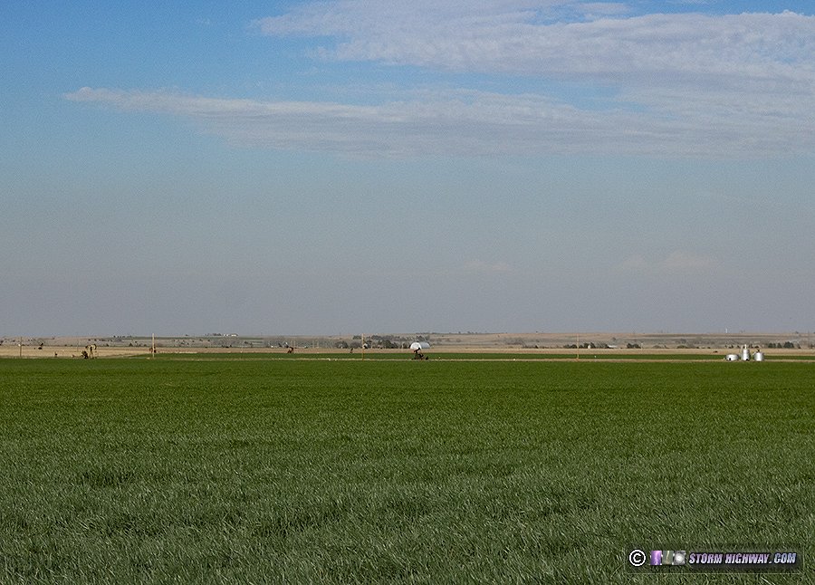
The Texas target was too far away to consider - it was too far away to allow me to get back to the Midwest setup with enough sleep. Models continued a trend of backing way off of the Midwest activity, so by noon, I was committed to the Plains. Nebraska's moisture issues looked too much to overcome for good storms there. By early afternoon, I had more or less committed to the Kansas target. With those storms not expected to fire until sunset or afterward, there was a lot of time to make the drive and take in the beloved Plains scenery and landscapes. I went to Russell, then headed south on US 281.
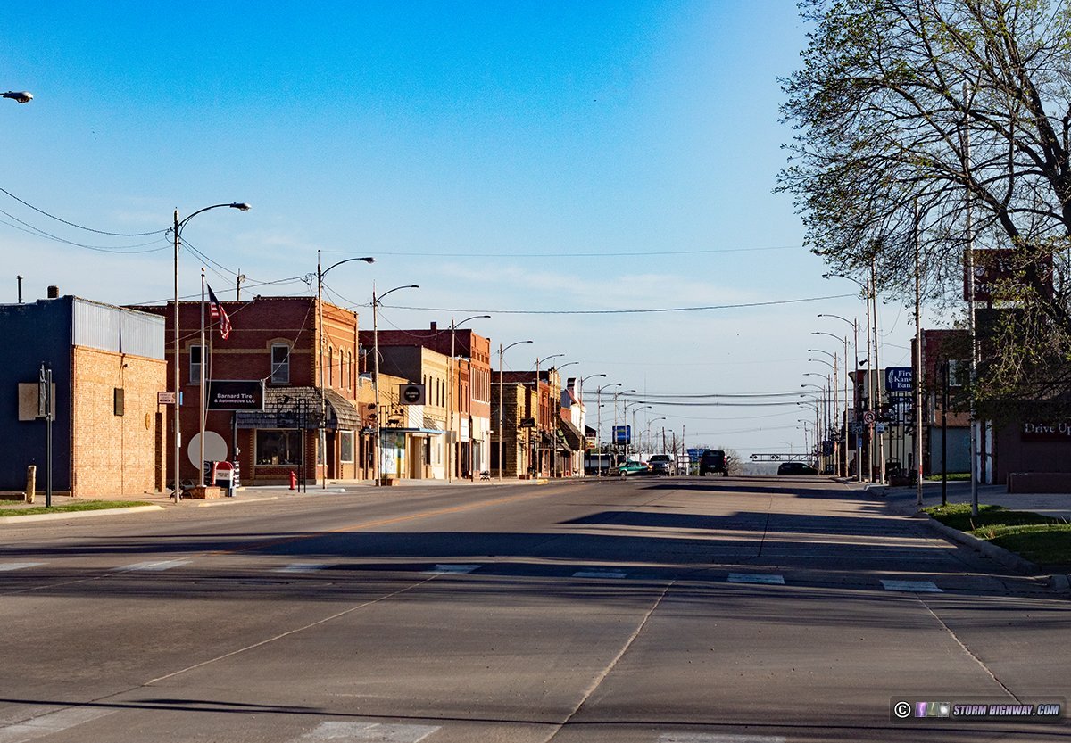
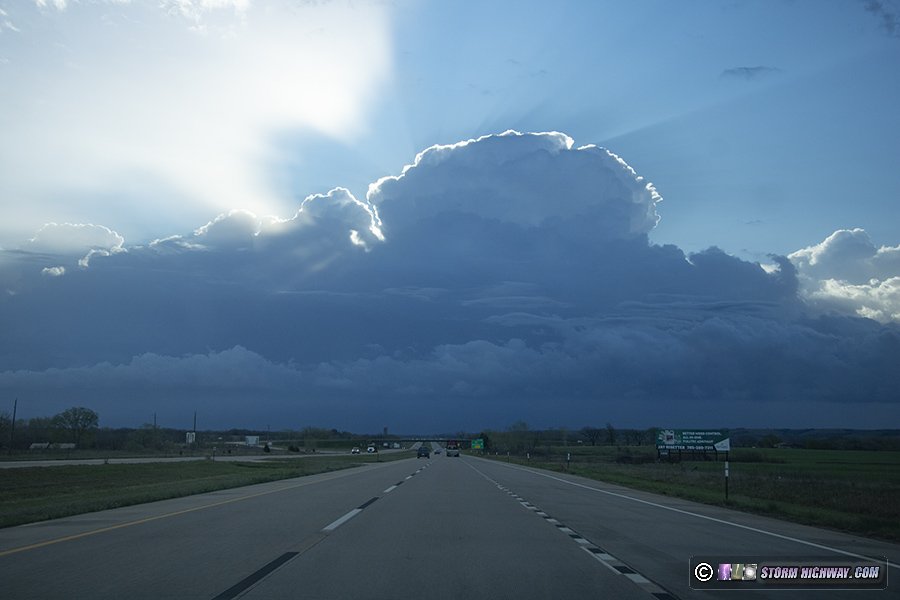
I passed through Hoisington in the late afternoon light...
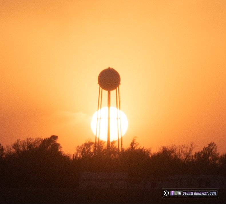
...then drove through Rozel at sunset.
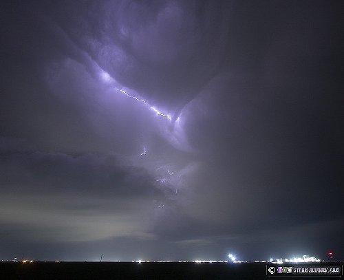
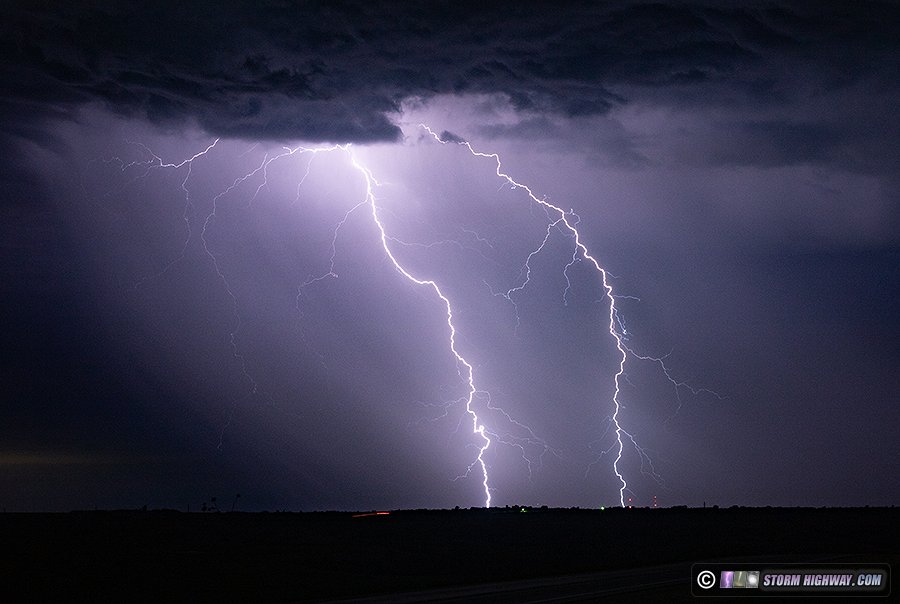
Radar showed the dryline was retreating to west of a Dodge City to Wakeeney line, and the last few visible satellite images before darkness fell showed agitated cumulus starting to appear along it. I headed west to Jetmore, then south to Dodge City as the first storm finally fired at 10PM. Lightning was starting to pick up, so I set up on the east side of town to shoot some stills. I couldn't see the updraft base yet from this point, and lightning channels weren't all that photogenic. There was this interesting pattern in the cascading forward flank precip illuminated by lightning:
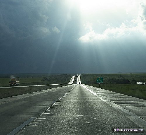
I had expected the storm to start turning right enough to make US 50 the better route to stay with the storm, but it was struggling to organize and still moving mostly north. So, I headed north on 283 to stay with it. I had to transect the core in Jetmore to get back ahead of the storm on 156 east. After this, the storm was not looking like it was going to do anything interesting in tornado, structure or lightning, so I decided to call the chase and start heading northeast so I'd still have about 7 hours to sleep before Tuesday's event. I stopped at Salina for the night.
Day 3: April 16: Supercells from Topeka, Kansas through northern Missouri (Trip #1 End)
This was technically a Midwest chase day - but my personal criteria is that if it's at the start or finish of a Great Plains trip without me going home in between, it counts as part of the Plains expedition.
I awoke at 7AM in Salina, Kansas and did my morning data check. Where supercells interacted with the warm front in Iowa looked like the best target. The wind fields, though, supported supercells and tornadoes throughout the warm sector in Missouri in two waves of storms. The second wave would develop thanks to a midlevel dry slot that was clearing the skies behind the first wave. Both the first and second waves were shown potentially affecting St. Louis, the better and later ones at sunset, so I wanted to keep my home area within range if that occurred. Overnight supercells that would constitute the first wave of these storms were still in progress, and were now just to my east. I approached a pair of them at Topeka, with the first one already crossing the highway ahead of me.
There was some interesting light as the sun broke through in between the cells.
I just barely beat the second cell to Topeka, but only found a fairly uninteresting RFD gust frunt shelf cloud and not much else in the way of structure.
More supercells and QLCS circulations were approaching from the southwest, and I stayed ahead of these through Kansas City. One of these circulations intensified suddenly near Lathrop, just to my west along I-35. I did not have a visual on it, but I was in the tornado warning polygon. Another circulation began developing at Cameron, Missouri. This had a pronounced RFD surge, and after it passed, a well-defined clear slot was visible. Motion was weak, however.
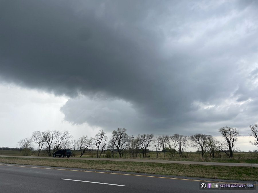
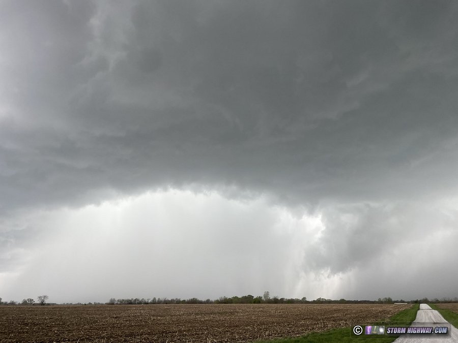
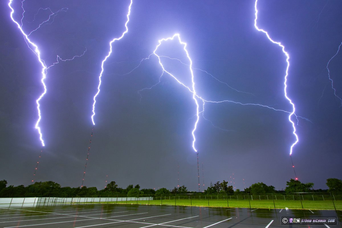
I moved east on Highway 36 to Hamilton to intercept the next circulation in the line. This one ramped up rapidly as it approached Highway 36, with very fast rain curtains crossing the highway at the leading edge of the RFD:
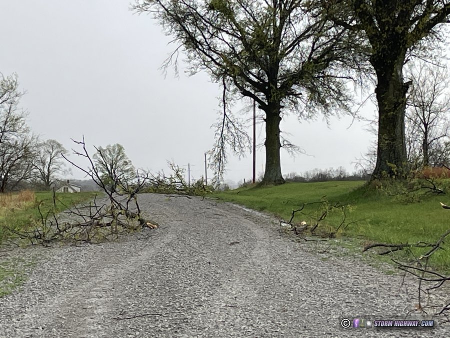
The circulation center was just to my east here. Southerly RFD winds became intense, possibly as high as 80 or 90mph. Radar showed a tight couplet had developed just north of the highway, possibly right over it, but this was completely rain-wrapped even at my close vantage point. After the circulation faded and moved off to the northeast, I backtracked through the path to see if I could find tornado damage. I found several large tree limbs snapped and pieces of sheet metal in a field along a narrow 100-yard wide corridor on either side of US 36, 3 miles east of Hamilton.
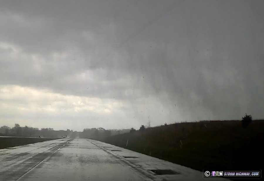
The storms to the southwest were beginning to show signs of organizing, so I moved northeast to Kirksville to get into position. These were struggling against a tendency to line out. I positioned ahead of one along Highway 63 north of Kirksville that had a cold, linear look with strong outflow all along it. The next cell to the southwest looked more isolated, so I moved over to Greensburg to intercept it. This had more interesting structure, with an RFD gust front curling back into where a lowering was evident. Motion in this feature was weak, however.
Storms were moving too fast to keep up with now, so I let this one go and moved south for the next one. The Greensburg cell went tornado-warned just 10 minutes after I left it, but I couldn't see anything due to the dense RFD precip. The next cell at Edina was also beginning to organize, but was high based when I arrived on it. I let this storm go, knowing I wouldn't be able to keep up with it. I had a good view of it to the northeast as it departed. Although it was remaining high based, an RFD clear slot was evident on its southwest flank:
I turned north out of La Belle intending to position ahead of new storms beginning to develop to the southwest, just as models had indicated. About 7 miles north of town, a turkey on the east side of the road took flight toward the road.
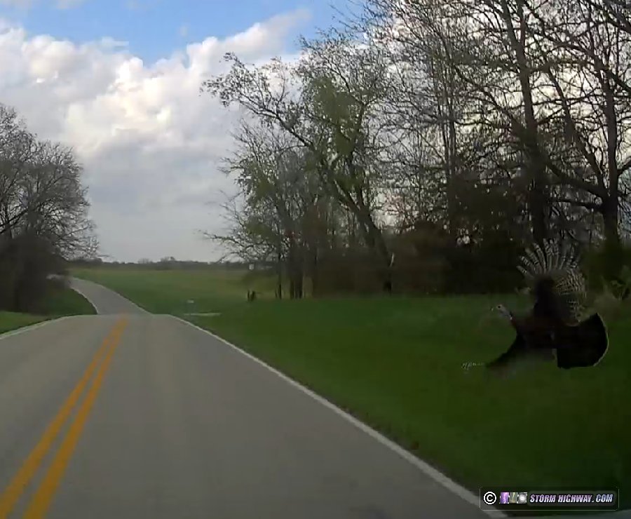
I hit it squarely on the right side of the windshield, creating a massive 6-inch deep crater spanning the entire height of the glass as shards exploded inward. The turkey had wedged against the hail guards, bending the main rails upward before it managed to free itself and somehow fly away. This obviously meant my chase was over.
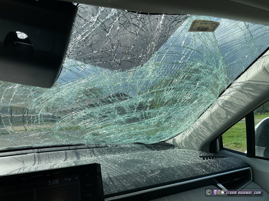
I immediately started looking for options to replace the glass, but it was just after 5PM and nothing was open in Quincy (the closest metro area that had any auto glass shops). With the driver's side of the glass thankfully still intact, I could see reasonably enough to slowly make my way south at 35mph on back roads (having to ford a creek at one point). New storms were continuing to form to my west and southwest, and I wanted to avoid them at all costs to keep water damage from making the incident worse. I managed to get south of the closest one at Palmyra, with was high-based and not doing much that made me want to stay and keep shooting.
Another high-based supercell organized to my west at Bowling Green, which I could see flickering in the twilight. At this point though, I was more concerned about getting home - so I let it go.
The damage to the hail shield rig was limited to the main rails, meaning the repair will be very simple: just two new rails and some drilling for the holes. And other than the glass cleanup and the cost of the new windshield and sensor calibration, there were no other effects to my car or equipment. All in all, this could have definitely been much worse, and I'm thankful for that. These incidents, and overall bad trips like this, are a part of chasing just as much as the good ones. I later found out that another chaser had suffered the same fate in Iowa. Day 4: April 24: St. Louis to Salina, Kansas, Council Grove lightning (Trip #2 Start)
I left after church on Wednesday night and made the drive to Salina on either side of midnight. On the way there, I stopped to shoot thunderstorms that were passing near Council Grove, Kansas.
Day 5: April 25: Supercells from Goodland to Scott City, Kansas
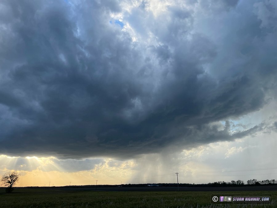
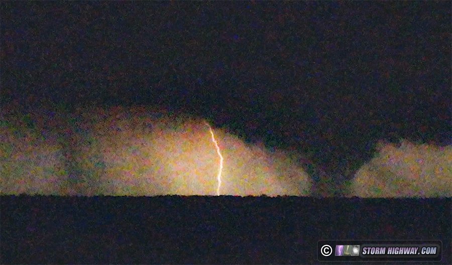
I slept late, grabbed a coffee and departed Salina after noon. My target was northwestern Kansas where storms would interact with a stationary frontal boundary, but I was also watching for development down the dryline to the south. As I approached Colby, agitated cumulus developed into a thunderstorm south of Goodland, so I continued west to it. This storm reached the frontal boundary about 10 miles north of town, at which point it began exhibiting signs of a mesocyclone. An RFD clear slot cut in a couple of cycles, one producing this funnel:
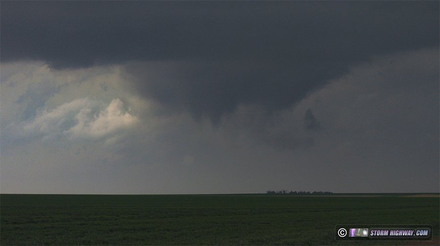
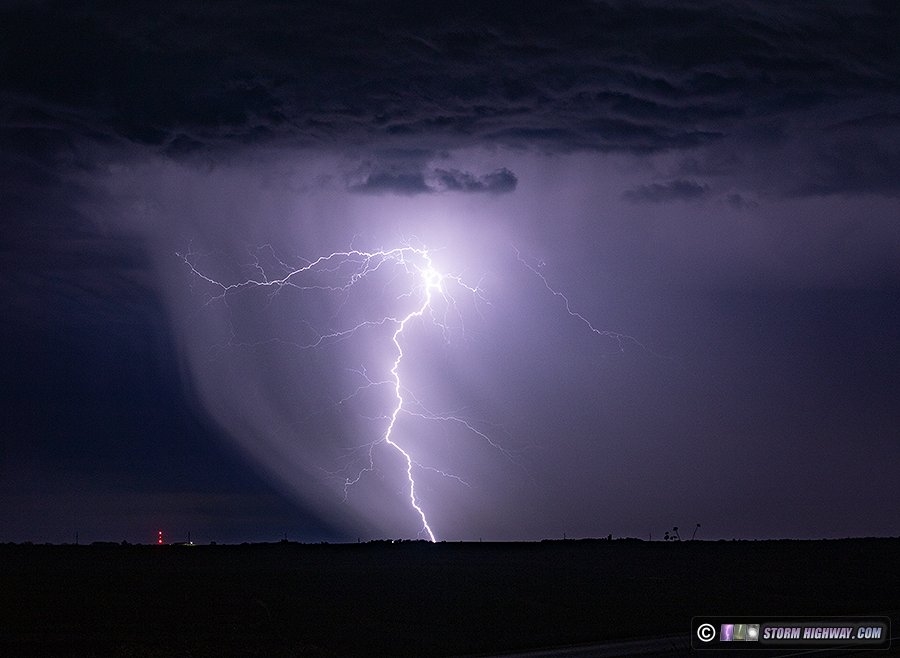
I did not see the reported rope tornado around this time. After the storm was completely across the boundary, its structure diminished considerably. So, I turned my attention to new storms farther south. Some were already across the boundary south of Oakley, and more were traversing it - but none were developing good low-level mesos. One was producing some decent cloud-to-ground lightning here, so I decided to spend some time trying to catch a few. None cooperated for my camera.
At this point, radar showed the boundary was being reinforced by storm outflow and actually sinking southward as a cold front. This pretty well spelled the end to any real tornado potential for the day. My oly play left was to get away from the boundary, down to the southernmost dryline storm near Syracuse. At Scott City, a new storm went up right over me that looked like it was in just as good of a position as the one near Syracuse. I decided to follow this one northeast, but it was high-based and never had a good look in its low levels.
I had just reached I-70 at Grainfield when a new storm went up just south of the old one. This one intensified rapidly, with a couplet developing south of the interstate. The storm could not wrap up at ground level, as it was already north of the boundary with cold, stable air at the surface. It was also getting dark, and the grungy environment north of the boundary was making it difficult to see much of anything structure-wise. After this storm moved north of the highway, I called the chase and started heading east. I once again stopped in Salina for the night. I could have gone farther, but I wasn't sure which road I would need to take in the morning (either Highway 81 north or I-70 east). Day 6: April 26: Numerous tornadoes from Lincoln, Nebraska to Osceola, Iowa
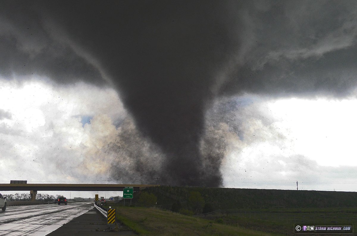
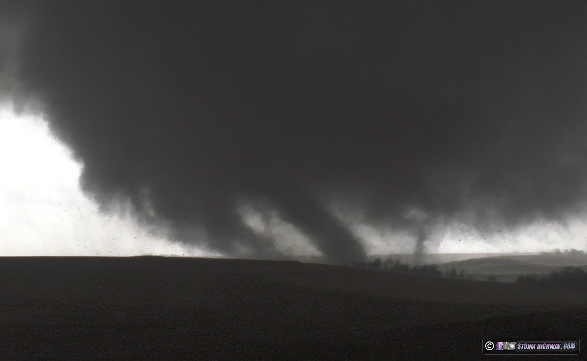
A top-5 chase day with 10 tornadoes in Nebraska and Iowa, with three close intercepts. This event has its own page here
Day 7: April 27: Foraker, Oklahoma tornado, Oklahoma City upward lightning
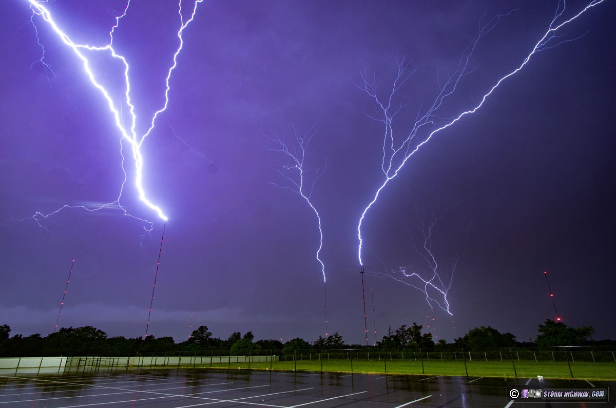
A tornado followed by a prolific upward lightning event in Oklahoma City. This event has its own page here
Day 8: April 28: Marginal thunderstorms in eastern Oklahoma/Missouri (Trip #2 End)
This originally did not appear to be a day worth expending time and money to stay another day in the Plains. The previous night's MCS had scoured moisture away from the dryline, and clouds/precip looked to prevent any good recovery from occurring in Oklahoma before sunset. So, I left Oklahoma City on I-44 toward home. At Bristow, I stopped for a data check to see that clearing was rapidly taking place in southeast Oklahoma, mainly south of I-40. I decided it looked interesting enough to go south to Henryetta and see what would happen. Storms initiated to the southwest as I arrived, and when I got my first look at them, they were cold and outflow-dominant messes without even much lightning. Thick cloud cover had also started building back in across the area ahead of these, and I decided it didn't look good enough to further delay my trip home. I turned north back to I-44 at Tulsa and continued the trek home. After passing through Tulsa, I saw reports of the photogenic tornado that had occurred just east of Henryetta over Lake Eufala (only a few miles from where I'd been). A small lead storm somehow was able to defy what looked like a very marginal environment.
I was watching for additional development along the line through Missouri as I drive northeast. Despite several tornado warnings south of the interstate, the storms continued to be messy with very little visible lightning. I didn't stop again for any of them, and arrived home at 11PM to officially bring the memorable Plains trip #2 to a close. Day 9: May 5: St. Louis to Emporia, Kansas (Trip #3 Start)
I left St. Louis at 8PM and made another uneventful late-night drive into Kansas. I stopped for the night at Emporia.
Day 10: May 6: Barnsdall, Oklahoma nighttime EF4 tornado
A long day ending with a significant tornado after dark. This event has its own page here
Day 11: May 7: Marshfield, Missouri to St. Louis (Trip #3 End)
I made the rest of the drive home on Tuesday morning, arriving at 2:30pm to bring the third Plains trip of the 2024 season to a close.
GO: Home | Storm Expeditions | Photography | Extreme Weather Library | Stock Footage | Blog
Featured Weather Library Article:
|