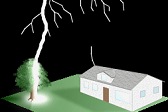
EF4 tornado at Hominy, Barnsdall and Bartlesville, Oklahoma - May 6, 2024

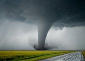
ABOVE: Tornadoes at Barnsdall, Oklahoma
4K CHASE VIDEO: Barnsdall EF4 tornado and power flashes
I witnessed a significant EF4 tornado after dark in northeastern Oklahoma as it tracked from near Hominy through Barnsdall to Bartlesville. Sadly, this was the second deadly tornado I've seen this season. This is a log of the day's chase.
I started the day in Emporia, stopping for coffee and a data check in Wichita. The best area for supercells and strong tornadoes appeared to be in central Oklahoma, which was the main area outlined by the the SPC's High Risk. My concern with this area was storms not getting started until late evening or at sunset. Farther north into Kansas, storms would be firing sooner as the main upper support would be arriving by early afternoon. There was a risk, however, for the Kansas activity to quickly evolve into a squall line. I felt that the chance for a good interval of daytime supercells and tornadoes would favor Kansas, and I figured that I would still have a good chance of getting south to the Oklahoma activity later. I targeted Medicine Lodge, Kansas which looked like it would be at the southernmost fringe of the Kansas activity and least likely to go linear.
Storms went up at Dodge City as I arrived at Medicine Lodge. I held my ground, since radar showed storms also developing just to my southwest. I moved north to Pratt to position ahead of these. The storms initially looked promising:

I expected to the storm to start turning right with Highway 61 the optimal road to stay with it. As the storm approached, however, it wasn't doing this and looked like it needed more time. I would need to go north to Highway 50 to get into position again. I lost the race with the core northward, and entered a barrage of 2 to 3 inch hail. My hail guards stopped about a dozen large stones from impacting the windshield, but a single one snuck in under the guards and broke the glass at the bottom. The hail guards otherwise did what they were installed to do, keep the glass intact enough that I can keep going without needing to end the chase trip until I can replace the windshield. Protecting the bottom of the glass would require an even-more-ridiculous rig that extends another 18 inches forward, which would require vertical supports for stability - and would also nearly completely block the view ahead for photos and videos (and the dashcam).

This maneuver wasn't worth the broken windshield. The storm went HP at Stafford and never made the expected right turn. I dropped south to Arlington to intercept a second supercell that had gone up south of the first one. As it approached, it became evident that it had already made the transition to linear mode - cold outflow all along it extending well south of the updraft. The Kansas play was already done.
Meanwhile, some nice-looking supercells in Oklahoma had developed much earlier than expected. The intercept point of the northernmost one was only two hours away, so I headed east to Wichita and south on I-35. I met the northern storm at Blackwell, but it was in the process of gusting out into a line itself. I dropped south to the now-stronger storm north of Perry. This storm was holding on to its supercell character, but was fighting a losing battle with a linear transition. I turned east ahead of it on the Cimarron Turnpike, stopping a few times to unsuccessfully get some high speed video of the lightning in the anvil region.
About this time, I noticed the new storms going up well ahead of the line to the southeast. I continued on to Hallett to intercept the better-looking one, which was rapidly organizing into a supercell with a strong mesocyclone. The couplet intensified to the point that I pulled over to wait for it to cross, since I couldn't get a good enough visual of the storm's base to see if it was safe to continue due to the trees and hills in this area.
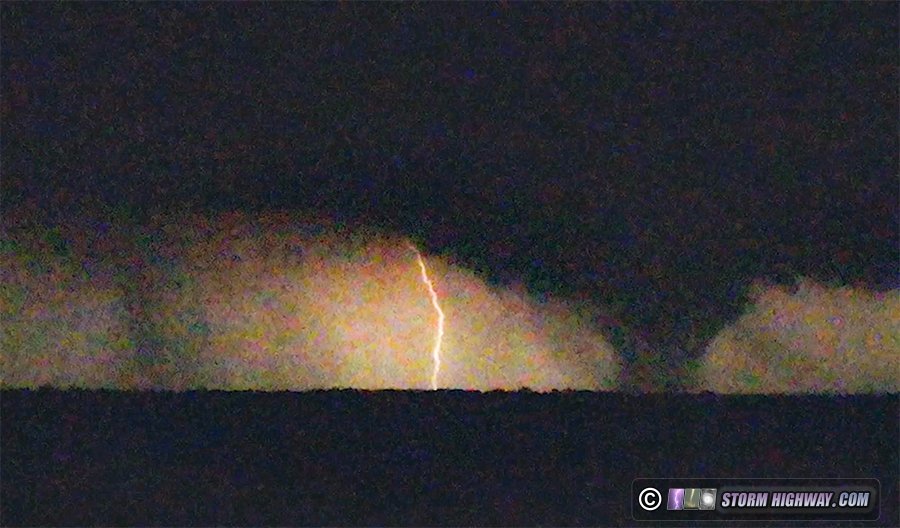
The couplet continued to intensify to the point that it was pretty clear there was a tornado in progress, or soon to be one. But I could not find a view anywhere - there were no open views to the north among all of the trees and hills. I finally gave up on this, stopped and sent my drone up hoping it could see something (for anyone who asks: I have my Part 107 and an installed anti-collision light, so this was a legal flight). To my surprise, not only was the tornado visible with the drone, but very clearly visible with high contrast. I recorded for 20 minutes. Nearly every lightning flash revealed a large and apparently significant tornado getting more distant. Several power flashes were also visible. There was what appeared to be a satellite tornado to the west of the main one for a few minutes.
Possible satellite tornado on the left:
More views from video:


I tried to get east to new storms ahead of the line southeast of Tulsa, but the squall line overtook the interstate before I could make it to my road due east. At that point, I gave up on the tornado part of the chase and unsuccessfully tried to shoot high speed of some of the lightning in the cores. I continued northeast toward home, stopping for the night in Marshfield, Missouri.
GO: Home | Storm Expeditions | Photography | Extreme Weather Library | Stock Footage | Blog
Featured Weather Library Article:
|