|
Home | Blog Index | Blog Archives | Christianity & Faith Essays | Storm Chasing Essays
May 2024 Storm Chasing Recap
This is a running-updates post of events covered in May of 2024.
May 2024 Event List
May 1: St. Louis shelf cloud
A stationary front bisected the metro area from west to east this day, and models showed storms firing on and near it by late evening. There was no upper-level flow, however, and models showed the storms dissipating after only a couple of hours. I didn't think it was worth taking more PTO hours to do more than just watch whatever happened to make it here. When the storms defied models and maintained intensity into the metro area, I took my lunch break to go downtown and watch them come through. The anvils of the storms had mammatus clouds colored by the setting sun:

I arrived downtown to see a surprisingly-structured shelf cloud moving in from the south.


The cores weakened to the west, but lightning was still active back east in Illinois. I stopped a couple of times in Caseyville and Fairview Heights to try to grab high speed video, but the lightning wasn't cooperative. After this the flash rates quickly slowed to one every minute or two, then longer. I decided the storm wasn't worth extending my workday hours any later into the night, and went back to the office.
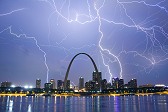
May 4: St. Louis lightning
Downtown traffic was nearly gridlocked during this day's storms thanks to the closure of I-64/I-55 in East St. Louis at the same time an afternoon Cardinals game was ending. I managed to get to a viewing spot to get some cameras on the Arch. Most of the lightning was east and south of downtown, but a few bolts were visible. The storm to the south sent outflow northwestward over town:

I also captured a few negative cloud-to-ground bolts at 6,000fps:

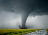
May 6: Barnsdall, Oklahoma nighttime EF4 tornado
I observed a significant tornado after dark in northeastern Oklahoma. This event has its own page here

May 7: Sulphur, Indiana tornado
I had just returned from Plains trip #3 at 2:00pm, and was only home for 30 minutes before leaving to cover this event. I could not make the best area in northern/central Indiana/southern Michigan in time, but the southern extent of the event along I-64 would not be firing until late afternoon and therefore would be within reach. I headed to the Fairfield exit east of Mount Vernon and watched agitated cumulus begin developing into a few showers. These were struggling to take off. Meanwhile, a much more robust cell was getting started east of Evansville, Indiana, and looked like a viable play. If the western activity did take off, it would be easy enough to go back to get it. The Evansville storm began looking healthy as I approached it at Ferdinand:

The storm turned right just before the meso crossed I-64, staying just south of the interstate. I made it under the storm at Sulphur in the heart of the Hoosier National Forest, one of the worst places on I-64 to intercept a storm. Nonetheless, I had a view of the base and wall cloud, which was visibly rotating with fast pre-tornadic motion in cloud tags at its base.

Less than a minute after I stopped, a weak tornado spun up under the wall cloud to the southwest of the Sulphur/English exit.

The mesocyclone tracked generally right along the interstate eastward. I had some great views looking up through the RFD clear slot with the meso just to the north, but low-level motion was weak.

Meanwhile, a new supercell just to the north produced a highly visible tornado near Sellersburg. My supercell's structure with a clear slot remained even as the storm continued weakening. This funnel-like feature appeared at Lanesville, but motion was very weak.

Models had indicated that supercells would develop back to the west near Evansville. So as my storm's reflectivity continued to fade, I let it go and returned west to Warrenton as new storms developed to the south and southwest. These quickly went linear with no supercell structure, so I didn't keep after them. I stopped to the north of a cell at Haubstat to shoot some of the lightning in the cores, catching a couple on stills:


No stratiform region was developing, so there was no opportunity for sprites or upward lightning as the storms moved away. I made it back home at 2AM.
May 8: Southwestern Illinois supercells and close lightning
Models had been consistent with an early morning complex of storms developing in western Missouri and plowing through the main risk area along the warm front too early in the day for good tornado production. Tennessee looked like a better play where the front and an outflow boundary would both see a good amount of sunlight before storms formed and tracked along them, but I didn't want to leave my home area in case storms here managed to overperform. I left home at noon to position at Ruma ahead of the long-lived supercell moving southwest of the St. Louis metro. As I left New Baden, mammatus from the storms were visible overhead:

This storm didn't have great structure as it approached, and new cells were continually going up on its southwestern flank. These new storms were developing into supercells. I cell-hopped down the line to Chester, stopping a few times to get a view of the storms with my drone (terrain and trees are problematic for storm observing here). This was the view of the first tornado-warned storm at Ellis Grove via drone:

Despite the tornado warning and strong couplet, the storm was visibly undercut with weak motion along the northern end of the RFD gust front. The inflow also felt very cold, a consequence of the early hour when the sun had not yet had time to heat up the low levels. I got one more drone view of the storm north of Chester when the couplet was strongest, but again didn't see any signs of a tornado or even strong inflow at the surface. I didn't think this storm was worth staying ahead of, choosing instead to wait for new storms developing farther southeast. These also went outflow dominant, so by mid-afternoon, I didn't have any storms within reach. A new cell near Carbondale produced a visible tornado about this time, but it was too far away to consider.
With no immediate storms within reach, I went into Perryville for lunch and to look at the next play. The outflow from the morning storms had pushed all the was south of Cape Girardeau, seemingly ending the tornado threat to the north. Despite this, the area behind the outflow and the morning storms was getting full sunlight and could possibly recover a little. New supercells far to the west near I-44 in central Missouri were north of this boundary, but the southernmost one could potentially reach it if the boundary could manage to lift back north a little. More storms were also developing over the St. Louis metro area, and I feared the original warm front might still exist in that area. After a few storms traversed the area where I thought that might be without organizing, I committed to waiting on the western storms.
The anvil cloud canopy from the storms to the west quickly moved overhead of the area, ending the very short period of sunlight and destabilization we had. So, I was not optimistic that the incoming storms would do much. I went north to Evansville to get ahead of what looked like a QLCS kink developing in the lead storm. This was eventually tornado-warned. I again sent the drone up to get a view of this, and despite some differential motion apparent at the location of the mesocyclone, it didn't appear close to producing a tornado.

Despite the lack of tornado potential, the structure of the storm was quite spectacular. I kept the drone in the air for as long as possible to capture the scene.

A close lightning strike hit just ahead of the line, visibly striking a tree:


100% crops of the above:


I dropped back south of Chester to view the last supercell in the line move across the Mississippi floodplain. It had some decent cloud-to-ground lightning activity, so I set up for daytime stills and high speed video, catching one bolt on both cameras:


After this, I went back north on I-55 into St. Louis to try to catch some new storms going up in the metro, but these were racing northeast and were out of reach by the time I arrived downtown. I went back home, choosing not to go south for another severe squall line to the south. I could see the positive lightning strikes in the stratiform region from along I-64, so I set up for a while outside of town. I caught this nice slow-to-fast positive CG in the stratiform region, as well as a few distant clear-air negative CGs from a new core that went up at the western edge of the complex:


May 10: Aurora borealis over the Arch in St. Louis
A once-in-20-years intensity display of the northern lights coupled with the Arch's lights being turned off resulted in what was possibly a once-in-a-lifetime photo opportunity in St. Louis. This event has its own page here.

May 11: Second night of auroras over St. Louis
I went out again on Saturday night to look for some new angles of what was expected to be another major incoming CME. I captured this short burst of auroras over the city from near Millstadt, Illinois. These were much weaker than the previous night's and did not show up well against the city lights.

GO: Home | Storm Expeditions | Photography | Extreme Weather Library | Stock Footage | Blog
Featured Weather Library Article:
|