|
Home | Blog Index | Blog Archives | Christianity & Faith Essays | Storm Chasing Essays
Boston: 9 inches yesterday / weekend storm update
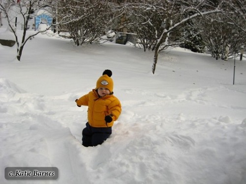
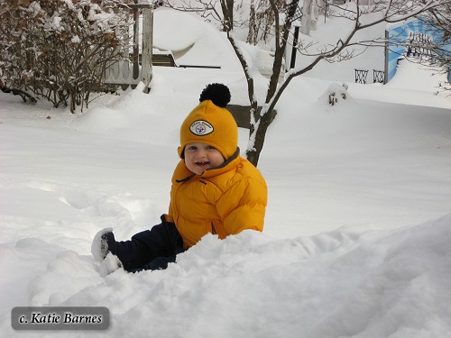
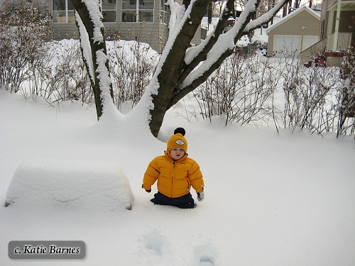
In the Northeast, the 'storm before the storm' on Thursday turned out to be a big event in itself. In fact, for areas along the coast, the coming nor'easter will probably deposit less snow than yesterday. My sister Katie and her husband Randy live in the Boston area, and sent these photos of their one-year-old son Caleb (my nephew) out in what was his first big snowstorm:
Weekend storm update 3
Today's morning model runs are out, and the trend keeps things staying on the warm side. Getting below freezing on Saturday night looks less likely now for most of West Virginia (except in the highest elevations). Both the GFS and WRF have even shifted the track of the low a little farther west, keeping West Virginia deeper in the warm sector of the storm and in a relative minimum of precip between two larger areas of rain and snow. The warm air looks like it may stick around longer, keeping things as rain even into Ohio for much of the event. Both models still show a sharp drop in temperatures midday Sunday as the low's cold front passes, quickly changing everything to snow areawide. With the warm air in place for so long before the snow starts, accumulations will be hard to realize on Sunday unless the snow is heavy enough. Totals are a toss-up now because of that - I'd say less than an inch if the snow is light, and maybe three or more if we can get a series of heavy bands to pass over. Bridges and overpasses will likely get icy though, once the cold front moves through and plunges temps into the 20s.
Extreme eastern West Virginia may experience a moderate ice storm on Saturday and Sunday as the rain begins over the cold air east of the mountains. Other than that, the precip onset looks to be too late everywhere else to cause ice problems on Saturday morning.
Quick model tutorial
If you're interested in following along with the forecast a little deeper, you can look at some of the model output maps yourself to see some of the things I reference in this blog. The links below will take you to UCAR's model interface which allows you to look at the maps for the RUC (12-hour short-term model) the WRF/NAM (mid-range, out to 84 hours) and the GFS (long-range, out to 180 hours):
MODEL OUTPUT LINKS: RUC Model | WRF/NAM Model | GFS Model
The GFS and WRF models are run twice a day, once in the morning (12 UTC or 7AM EST) and once in the evening (0 UTC or 7PM EST). The supercomputers used to run them are usually done producing all of the final outputs by 11:30AM and 11:30PM each day (since running a model is calculation-intensive and takes several hours). The short-term RUC model is run hourly all day.
You'll want to look for agreement between the different models and consistency between successive runs to determine the believability of a forecast. Models typically get more accurate as the event gets closer, but they are rarely 100% correct. Remember that models are intended to give you a good idea of what might happen, not precisely what will happen.
GO: Home | Storm Expeditions | Photography | Extreme Weather Library | Stock Footage | Blog
Featured Weather Library Article:
|