|
Home | Blog Index | Blog Archives | Christianity & Faith Essays | Storm Chasing Essays
Defiance-Chesterfield, MO nighttime EF3 tornado - December 10, 2021
4K VIDEO: Defiance-Chesterfield tornado crossing I-64 with power flashes
DAMAGE SURVEY: Official NWS damage surveys for December 10 tornadoes
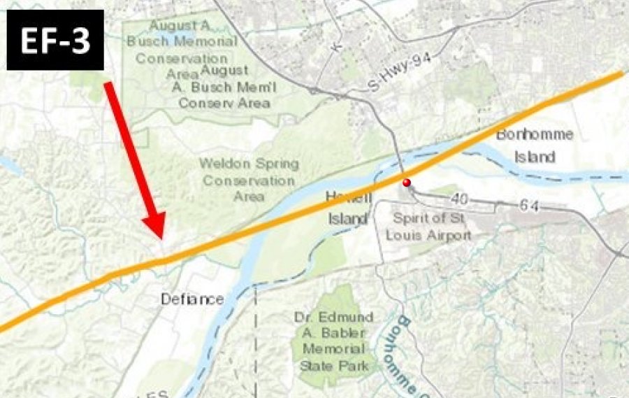
CHESTERFIELD, MO - I observed a tornado at close range crossing Interstate 64 (Highway 40) at Chesterfield in western St. Louis County at around 7:45PM on Friday night, December 10. The red dot on this NWS survey map marks my location during the tornado's crossing of the highway:
This event's potential was evident in models for almost a week prior. A powerful jet streak was shown evolving on the leading side of an upper-level trough sweeping across the central US. The tornado risk areas originally depicted on models were well to the south and east of the lower Midwest. In the days leading up to the event, models both increased the tornado risk and moved the threat area farther north and west into the St. Louis metro area. Rich low-level moisture was shown pushing farther to the north under the screaming upper-level wind field. By the time we reached the 24 hour point before, St. Louis was well inside of a high-end tornado risk.
During most tornado events in the Midwest, I nearly always choose to stay in my home region if there is any appreciable risk in the St. Louis metro area. In this case, the risk actually appeared to be just as high in St. Louis as it would be in regions farther south. As the moisture surged north into the evening, our dewpoints rose past the 60 degree mark while surface winds backed and increased. The tornado threat in St. Louis looked quite serious, making it a no-brainer to stay in my home region instead of my secondary area of interest down in the Missouri bootheel. The strength of the upper level wind field would mean that storms would be moving too fast to keep up with (50 to 60 mph or more), so the plan was to "cell hop" east and/or south on the interstates in the region - that is, catch the updrafts/mesocyclones of storms as they crossed the highway, then instead of chasing after them, leave them and jump downstream to the next storm.
I left home just before sunset and headed to St. Charles as my initial staging point. Storms had developed in central/southwestern Missouri near Springfield and would begin affecting the St. Louis metro after 7PM. The initial development was linear, but I expected these to quickly separate into discrete storms as the wind fields became more conducive for supercells. I expected to begin intercepting storms on I-70 west of the metro area, but I wanted to stay close enough in case a leading cell went up ahead of the ongoing activity. Eventually, it became clear that no lead storms were developing, so I moved west to Foristell for the first storm of the night.
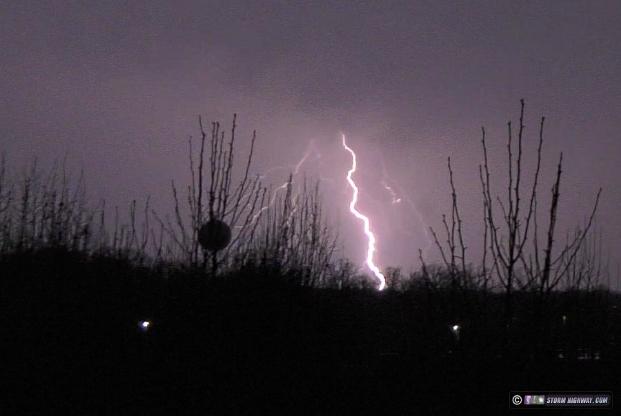
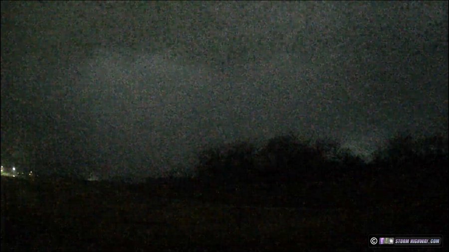
I was only in Foristell for a few minutes before the evolution of the two southernmost storms suggested that they were going to be the primary threats to the heart of the metro area. Not wanting to risk missing them due to the blazing storm speeds, I abandoned the weaker circulation heading toward an I-70 crossing west of Wentzville and moved down Highway 40 (I-64) to Weldon Spring. The storm's circulation intensified quickly, the tornado warnings were issued and the radar began showing debris near Defiance (later surveys would rate the damage in this area as top-end EF3). I had a good view of the storm from the Weldon Spring exit of I-64, but could not make out any storm structure. Lightning was frequent in the forward flank of the storm, silhuetting the National Weather Service NEXRAD radar dome (KLSX):
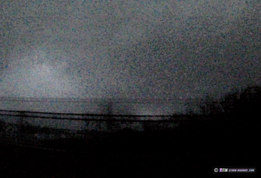
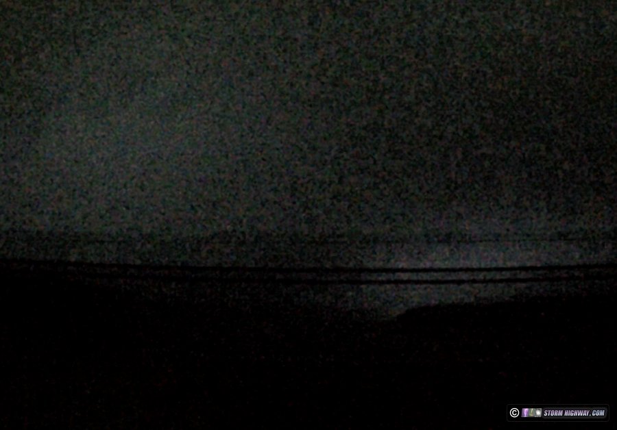
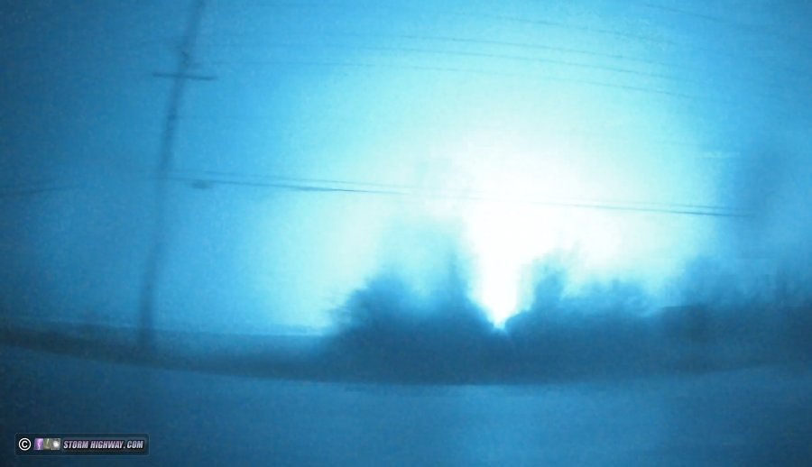
I decided to position closer to the radar-indicated circulation's crossing of Highway 40 (I-64) which appeared to be at the Daniel Boone bridge. As I crossed the bridge, I had several lightning-illuminated visuals of the approaching tornadic region of the storm. These screen grabs from my passenger-side dashcam show the tornado approaching over the Missouri River. Thankfully, this area along the river is not populated - but this also meant that there were no lights or power flash sources to illuminate the approaching tornado.
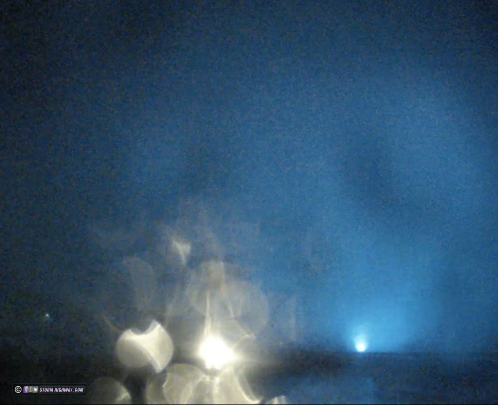
I pulled over just past the start of the offramp for Chesterfield Airport Road (next to the St. Louis Premium Outlets mall). The wrapping rear-flank downdraft (RFD) was visible in one lightning flash in this image from my passenger-side dashcam (the lights from the outlet mall are on the left):
After about 30 seconds, the inflow into the tornado engulfed the outlet mall and my location, with easterly winds rapidly increasing. As these winds continued to ramp up to alarming levels, I moved east another few hundred feet, mainly being concerned about the tornado clipping the outlet mall and sending that debris into me. Power flashes marked the tornado's crossing point just behind me:
As the initial RFD moved away and I had a brief period of rain-free air over me, I could clearly hear the tornado moving away to the north with the classic "waterfall" sound (included with the video recap of this event). Again, it was in the unpopulated wooded area along the river, so there were no human illumnation sources (lights or power flashes) to make the tornado visible. A larger area of heavy rain and strong southwesterly RFD winds swept overhead in the minutes following. I observed several power flashes from these winds (non-tornadic) near Highway 40 and Long Road.
My next objective was to jump east to catch the second storm moving through the metro east of I-270. The hydroplaning risk along Highway 40 (I-64) from Chesterfield to I-270 was very high, and my speed was limited to 45mph. A car ahead of me lost control and nearly struck the right side guardrail (captured on my dashcam and included with the video recap of this event). Thanks to the road conditions reducing my speed, I only just barely caught up to the second storm's circulation at Ladue. I observed a power flash over Ladue, but this appeared to be from the RFD winds. I could not see any storm structure despite the good illumination of it from Clayton's city lights.
At this point, there were no other immediate storms downstream - so I made an attempt to catch up to the seconds storm again, hoping to re-intercept it near Glen Carbon. However, when I arrived at the river in downtown St. Louis, the storm was already crossing the river to my due north! There would be no way to catch up to it with the long due-north leg I had to traverse on I-255 from I-64. With fast storm speeds, a northeast-moving storm is impossible to keep up with when you only have east-west-north-south road options. If I had continued on, I would have been about 15 minutes late for the tornado that struck the Amazon plant near I-255/I-270.
The next round of storms began approaching the metro area at 10PM. By now the main surface low was in northern Illinois east of our longitude, meaning our surface winds had veered considerably. This greatly reduced the tornado threat with this second round of storms, which stayed linear as they moved through. I kept just ahead of the tail-end of these cells from Kirkwood through downtown St. Louis, finally letting them go at Caseyville - and they were uneventful during this time.
The third round of storms approached the eastern side of the metro area (Illinois) an hour later. Despite the veered surface winds, this third round had better tornado potential thanks to the continued advection of warm, moist air from the south. I intercepted a tornado-warned circulation on Highway 161 between Bartelso and Hoffman in Clinton County. The circulation was completely rain-wrapped, and with the less-frequent lightning, no supercell structure was visible. The RFD had a good punch to it as the circulation passed to my north east of Hoffman. I found no damage upon backtracking through the circulation's path on my way home.
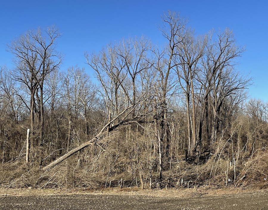
On Sunday, I returned to my intercept location of the Defiance-Chesterfield tornado. Thanks to the network of bike trails through this area, the entire crossing point was walking-accessible. Snapped and toppled trees marked the tornado path just a few hundred yards from the west end of the outlet mall. This topped tree fell to the north, with many snapped branches on other trees:
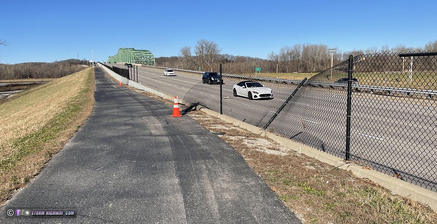
The clearest indicator of the tornado's exact path was the toppled section of fence dividing the Katy Trail connector from the eastbound lanes of Highway 40, just east of the Boone bridge. Most of the fence was pulled north onto the highway. Cars on the highway suffered not only wind/debris damage from the tornado, but several had punctured tires after driving over the fence debris.
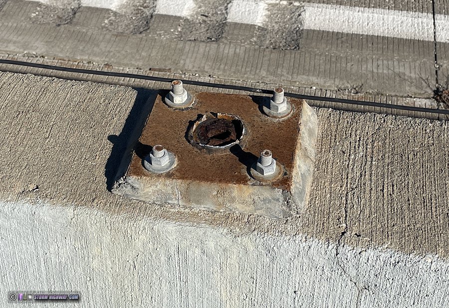
The fence posts were sheared off at the base:
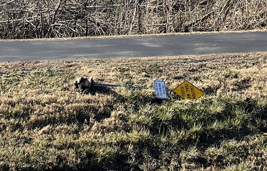
This sign along one of the bike trails was pulled out of the ground. The sign had toppled to the west, an indicator of cyclonic winds when compared to the northerly direction of the large tree and the fence.
Youtube video of this event: (watch on Youtube)
GO: Home | Storm Expeditions | Photography | Extreme Weather Library | Stock Footage | Blog
Featured Weather Library Article:
|