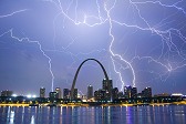
Three Gateway Arch lightning strikes in one hour: The rare St. Louis storm of July 19, 2020
All images and videos on this page are © Dan Robinson - all usage requires a paid license.
1500FPS VIDEO: Slow-motion video of lightning strikes to the Gateway Arch and St. Louis buildings
I have been documenting St. Louis storms since I moved to the metro area in January of 2010. During that ten-year plus time, I have covered the entirety of most thunderstorms that have affected downtown with either a video camera, DSLR (still) camera or both. The result of that effort is that I have an empirical count of the number of lightning strikes to the Gateway Arch that have occurred during that time. I go into that count in detail in my article about how often the Arch is struck by lightning. The average strike rate is less than once per year, with as many as four of the last ten years seeing no Arch strikes at all.
That sets the context for how rare the July 19, 2020 storm was in terms of cloud-to-ground lightning over downtown St. Louis. In 58 minutes, the Arch was struck directly three times during a long-duration barrage of bolts over the city. That's about four years worth of strikes in less than an hour!
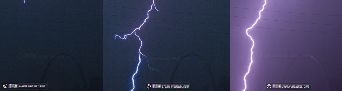
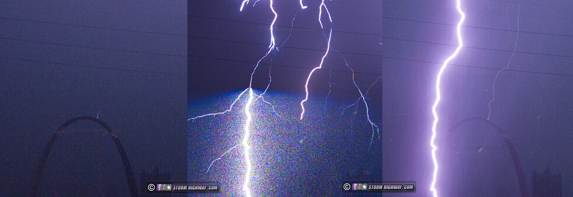
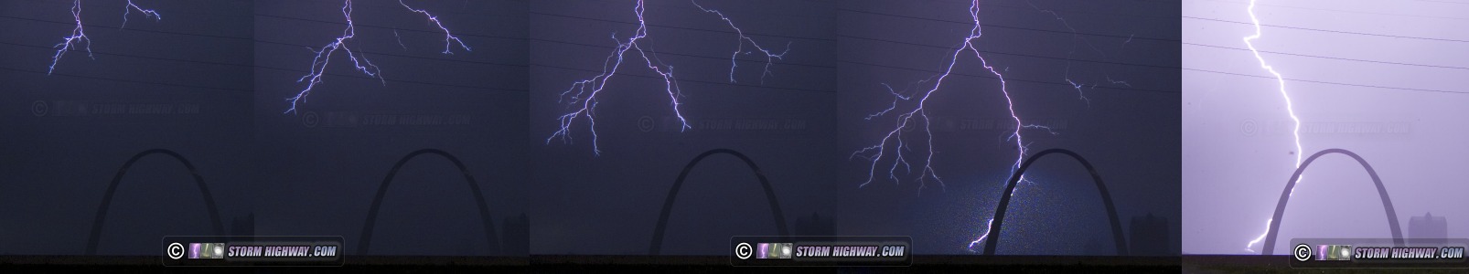
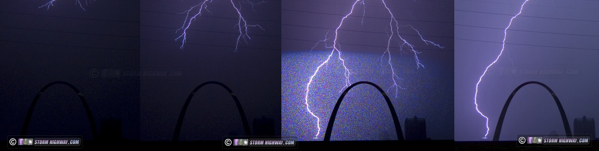
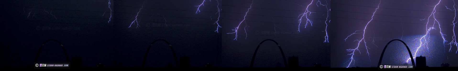
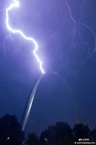
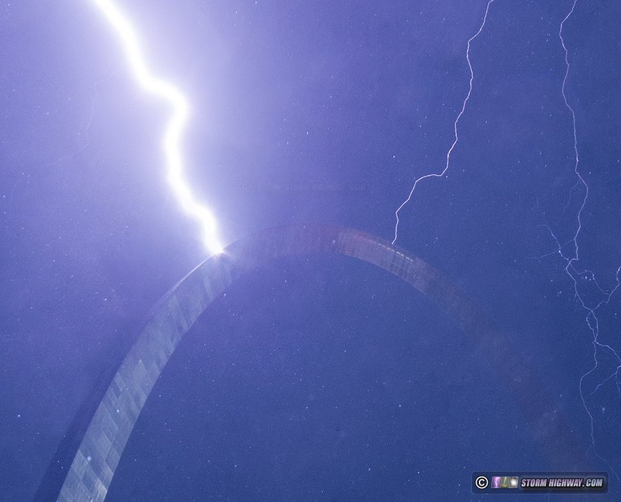
Unlike several maddening misses over the past decade (I go into those in the aforementioned article) I was blessed to be there for the duration of this storm with cameras rolling, capturing all three direct strikes: the first two on 1,500 frames per second high speed video, and the third on a high-quality DSLR still image.
In this article, I'll go into a frame-by-frame analysis of each high speed shot of the July 19 storm, including the Arch strikes.
Video (1500 frames per second)
Meteorological synopsis
July 19, 2020 was characterized by strong instability (MLCAPE over 3000) areawide ahead of a slow-moving cold front sagging southward across the lower Midwest (SPC Event Archive). Midlevel flow was weak, with less than 20 knots of bulk shear across the lower Midwest - but slightly stronger than previous days thanks to an upper trough axis passing well to the north in southern Canada. The westerly flow was enough to keep storms moving east instead of being completely stationary. Daily thunderstorms over the previous week resulted in outflow boundaries that served as the focus for new storms each afternoon. Weak capping had resulted in widespread thunderstorm development early in the day for much of the previous week, with the atmosphere turned over and overspread by storm outflows in the low levels by early evening. This day, however, a bubble of warmer 700mb temperatures passed by just to the north centered on Keokuk, Iowa. This additional capping presented more of a hindrance to thunderstorm development over the St. Louis area until later in the afternoon when instability was maximized. Midlevel lapse rates also improved going into late afternoon across the Midwest, contributing to more robust thunderstorm updrafts.
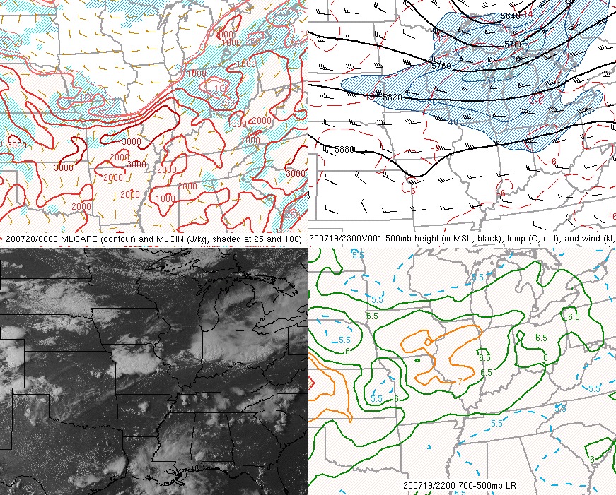
MLCAPE, 500mb chart, visible satellite and midlevel lapse rates just before storm initiation.
The first storm fired directly over downtown St. Louis at 5PM, quickly moving into Illinois before producing short and unremarkable bursts of cloud-to-ground lightning. This storm collapsed and sent an outflow back west, which stalled over/just west of downtown. This boundary would prove instrumental in focusing the impending event over the city. At 7PM, more robust and sustained thunderstorms fired on this outflow northeast of downtown with prolific and frequent cloud-to-ground lightning. As the convection backbuilt southwest along the earlier outflow, the lightning barrage entered downtown just before 7:30PM.
At the same time, another area of strong storms developed in the southern metro area and moved north toward downtown, eventually merging with the ongoing storms over the city and extending the lightning barrage overhead through 8:30PM. The cloud-to-ground lightning finally cleared the city after 8:45PM.
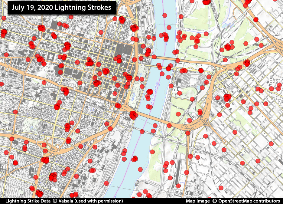
Lightning Strike Data (NLDN)
I ordered a NLDN (National Lightning Detection Network) report from Vaisala for the time period from 7PM through 10PM CDT. This data shows all lightning strokes in and around downtown during these storms, and gives a great visual of how prolific this event really was. Note that some individual lightning flashes have multiple return strokes, which show on this map as close clusters of points. Thank you to Vaisala for granting permission for this data to be published here.
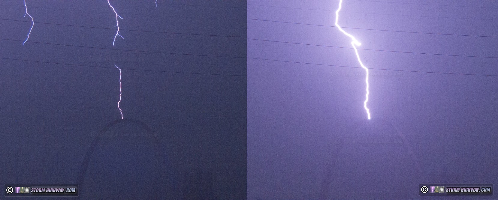
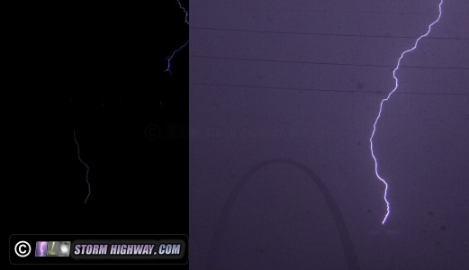
First Arch strike: 7:30PM CDT
Both the first and second Gateway Arch strikes occurred as part of a multiple-ground-connection negative cloud-to-ground flash. On one frame of the 1500fps video, the negative stepped leader can be seen descending from the top of the frame as an upward positive leader initiates from the Arch toward the descending negative stepped leader: |